Bitterroot Traverse Overview & Trip Report
130 miles across the Bitterroot Range of Montana and Idaho

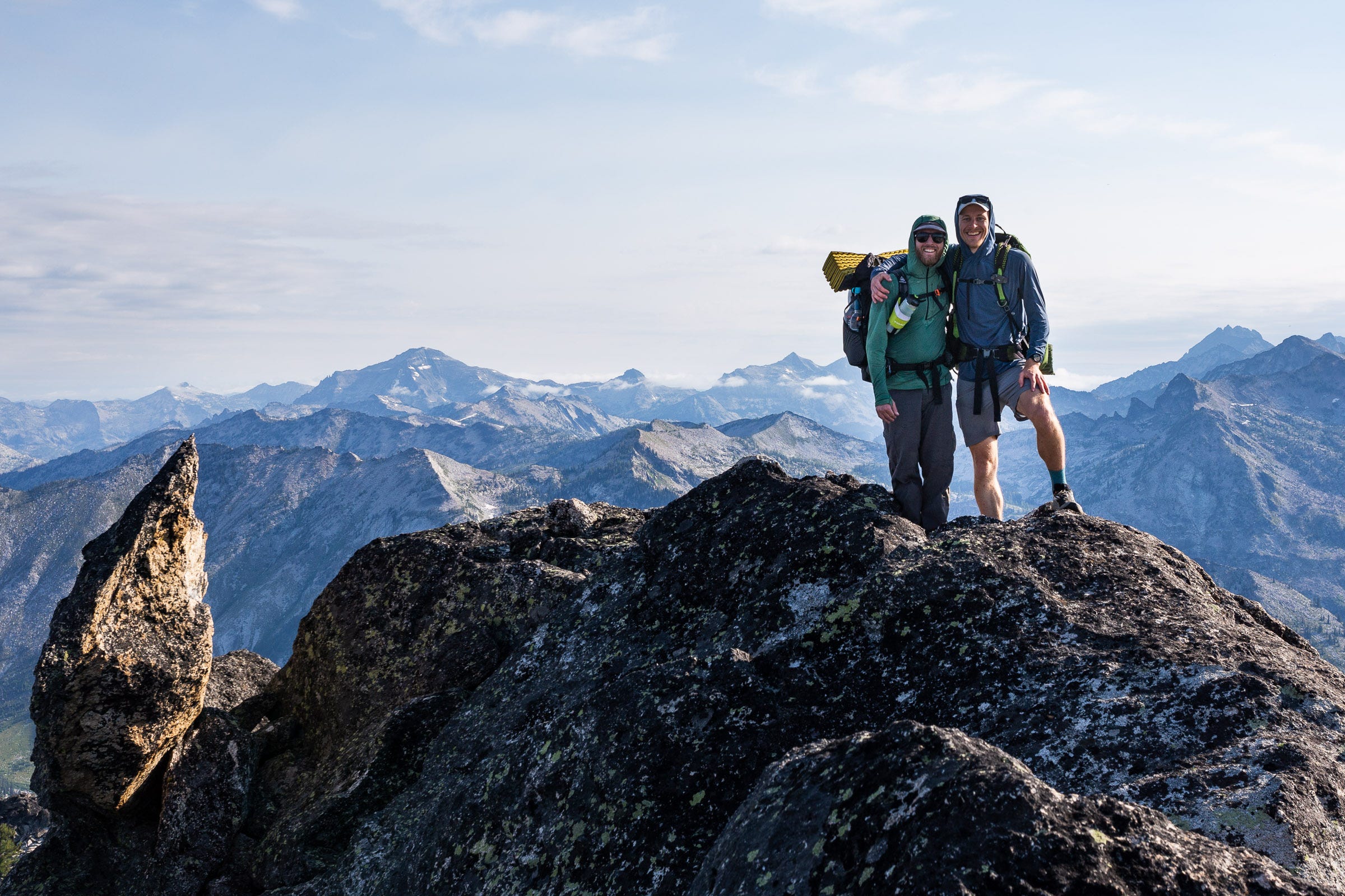
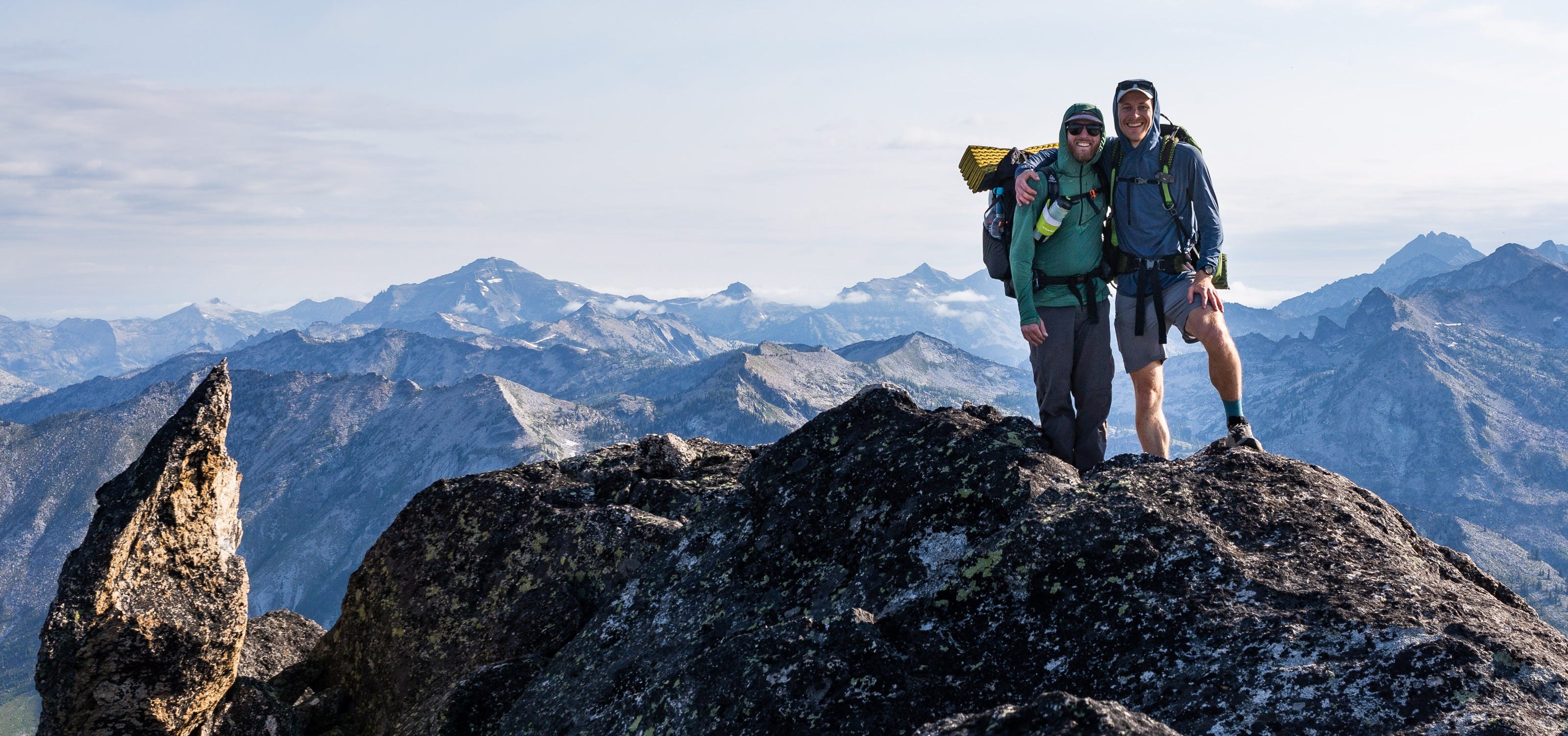
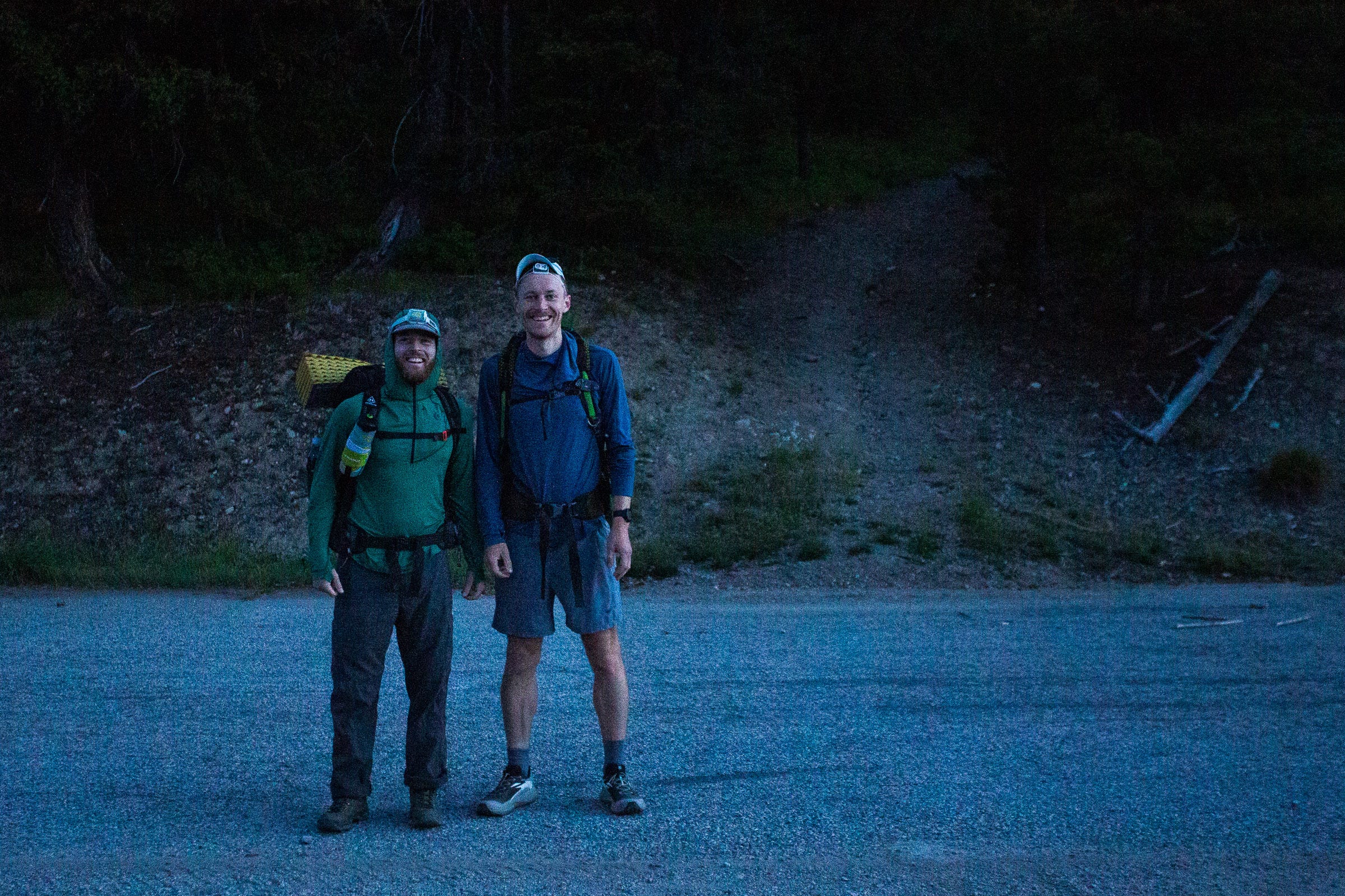
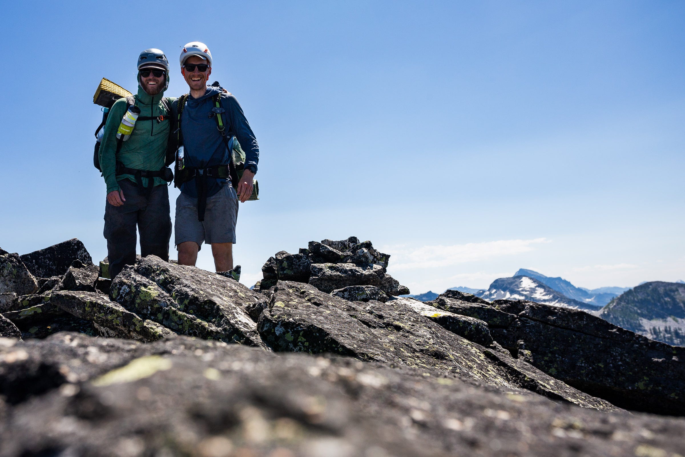
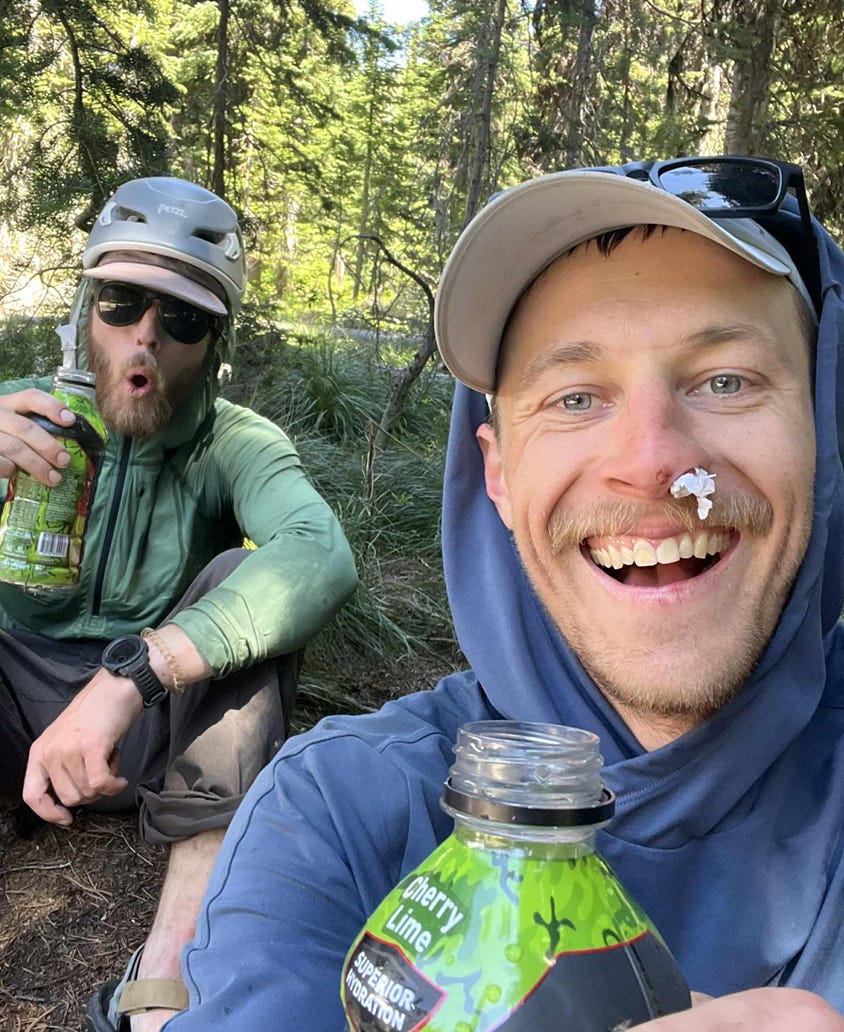
In July 2025, I completed a traverse of the Central Bitterroot Range, from Nez Perce Pass to Lolo Peak. Below, I’ll refer to this as the Bitterroot Traverse. My friend Josh Beisel joined for the first half, before he had to get back to Missoula.
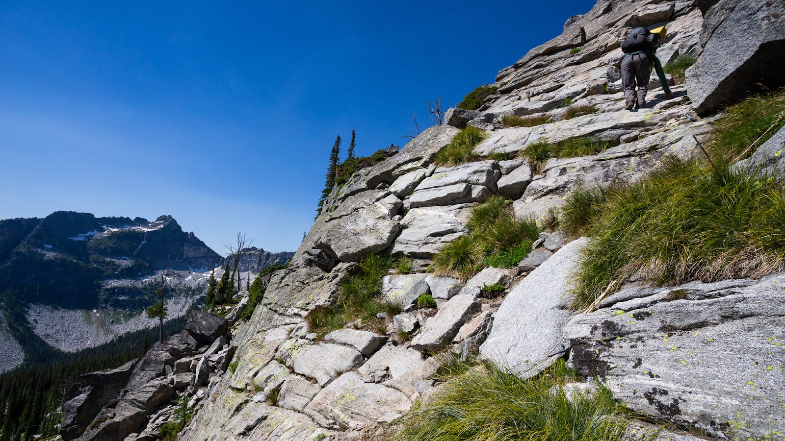
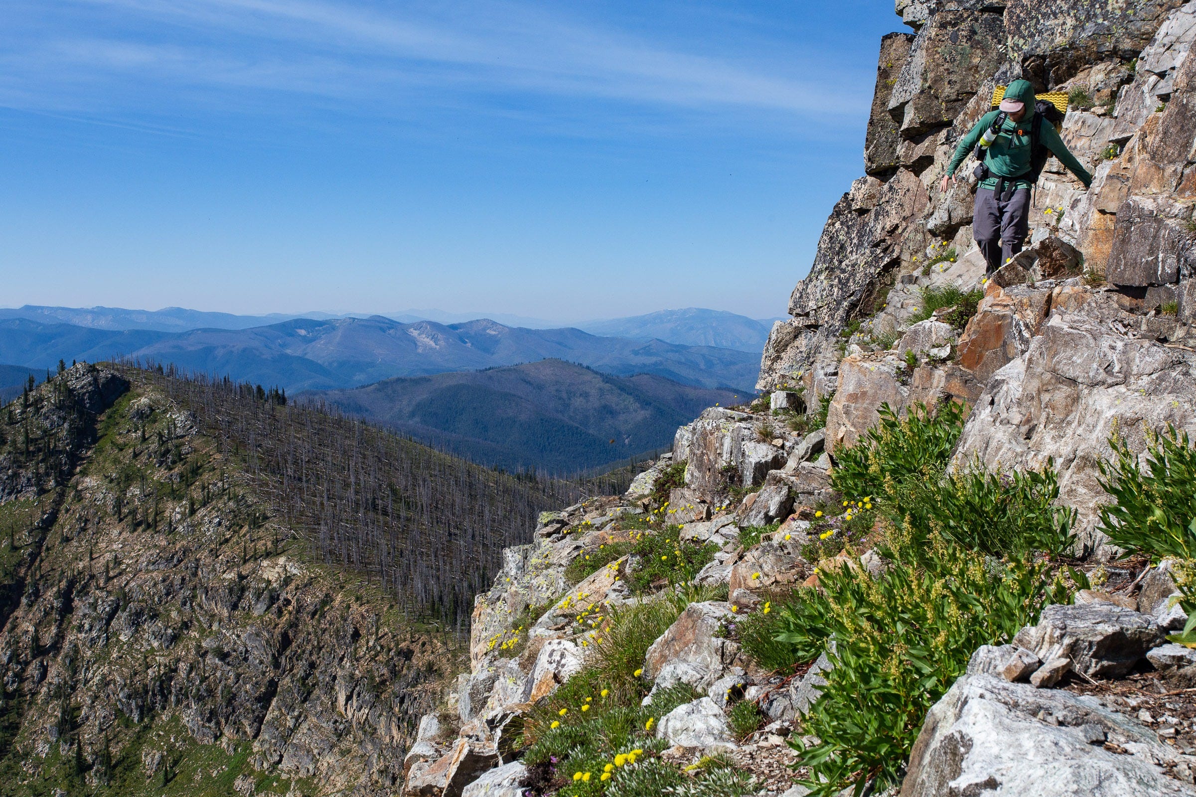
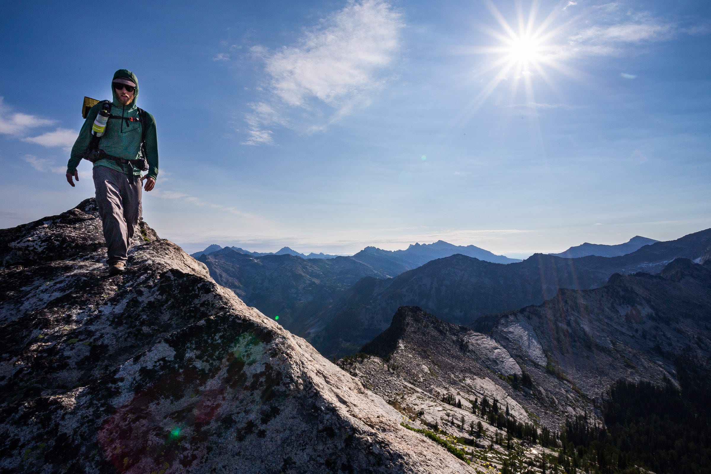
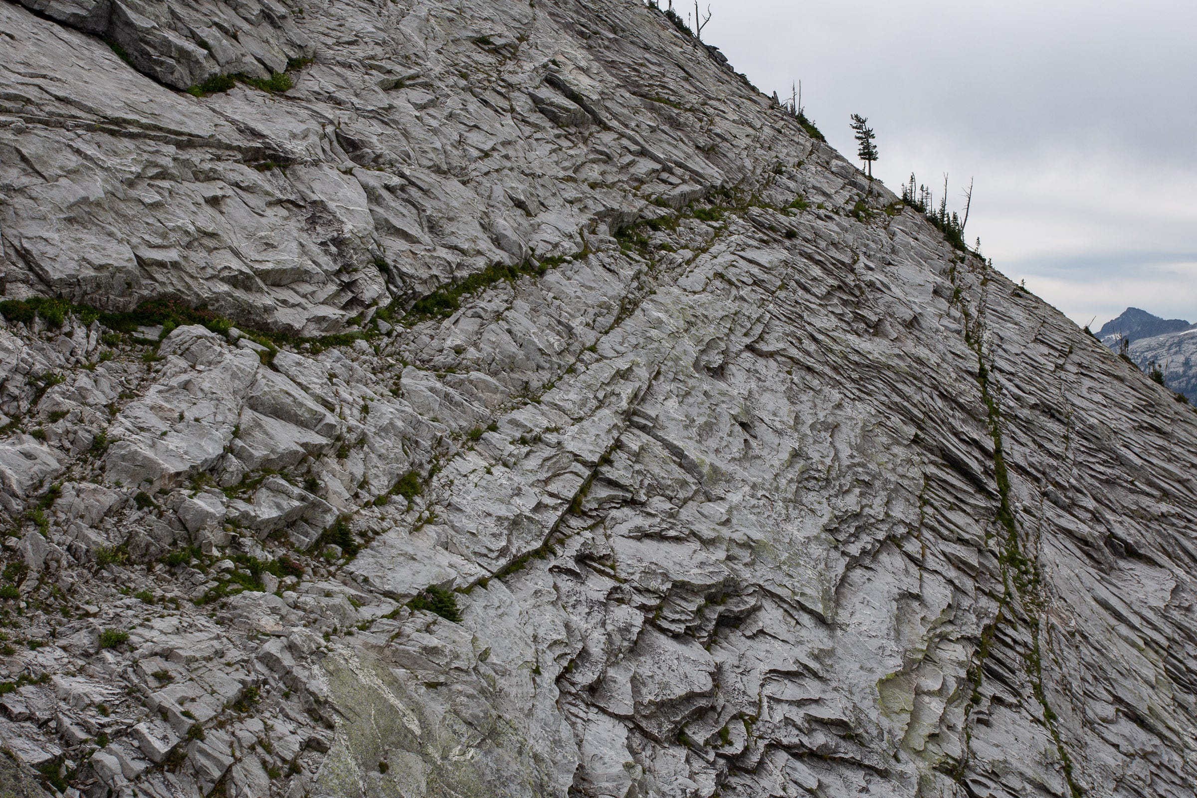
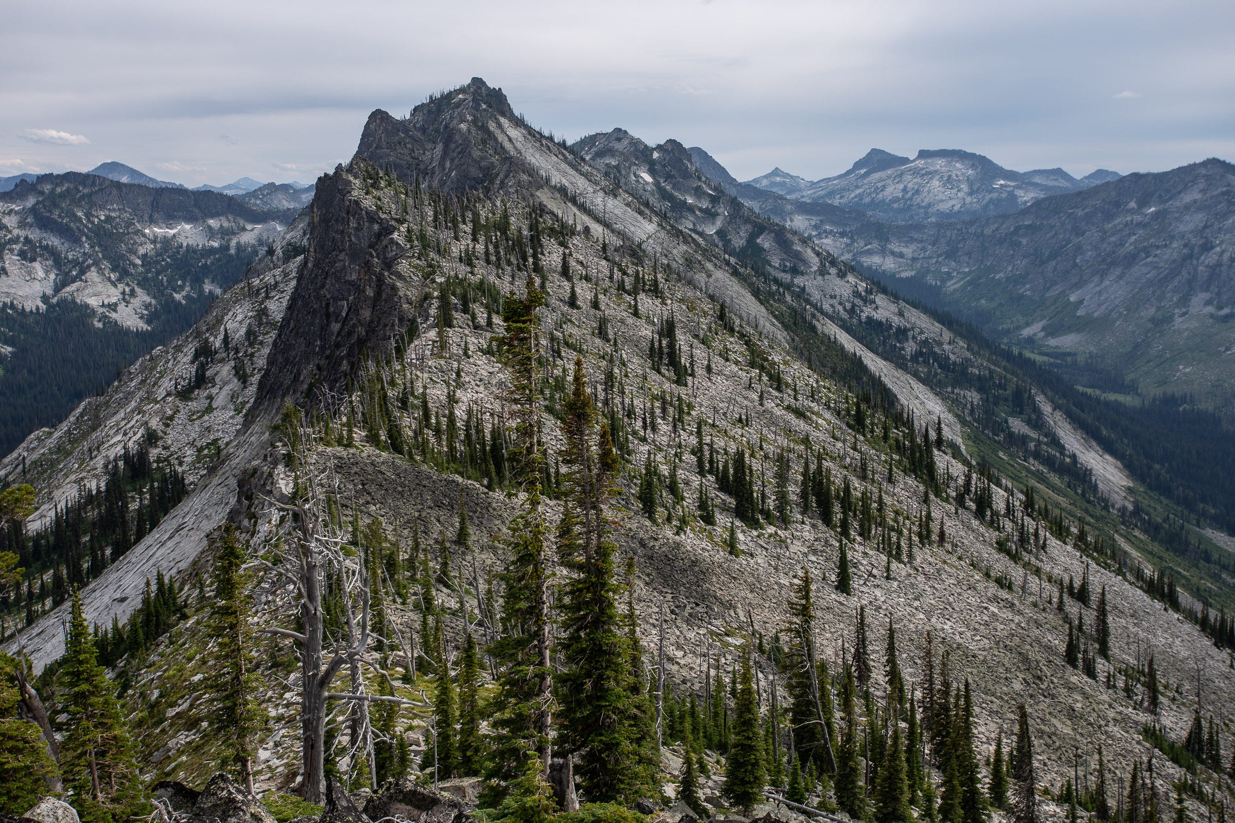
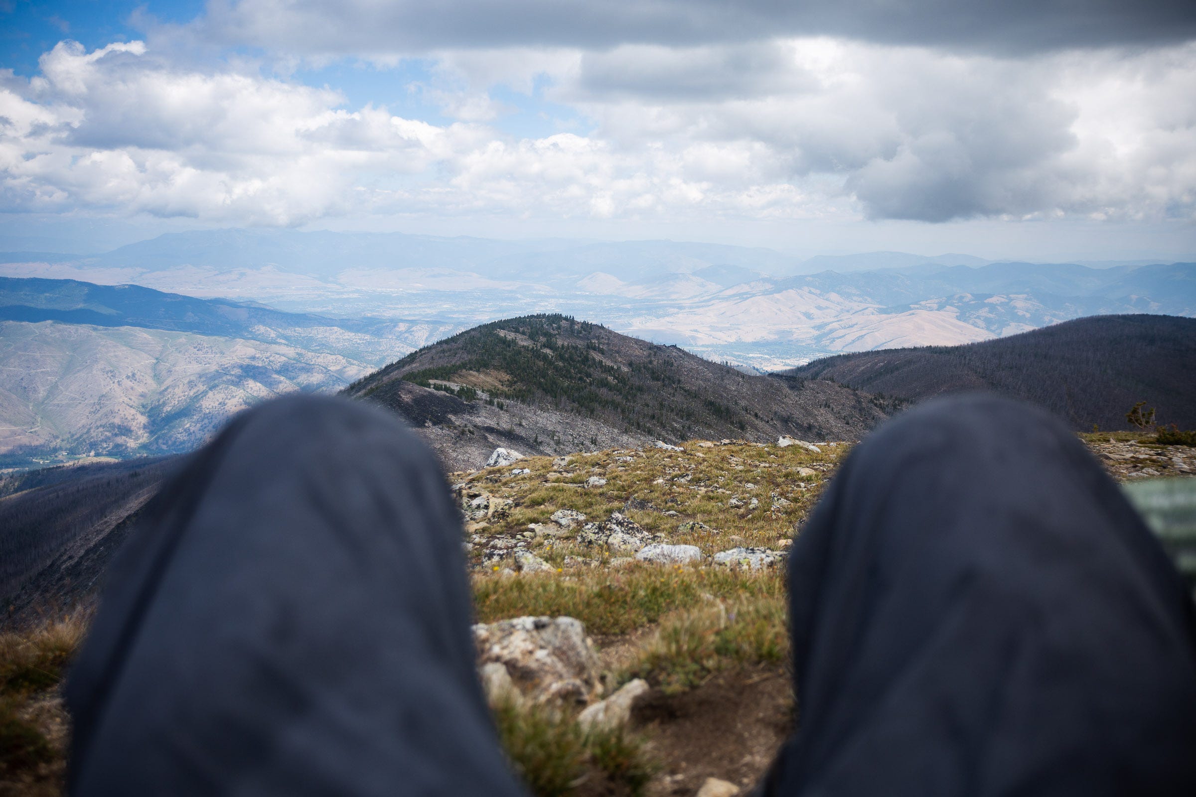
The traverse follows the main ridgeline of the Bitterroot Mountains, a subrange of the Bitterroot Range. For most of its length, the crest is also the border between Montana and Idaho. The main ridgeline includes over 30 peaks (following the 300’ prominence convention), most of which are unnamed. The ridgeline proper is roughly 111 miles, with approximately 55,000 feet of vertical gain. With the exception of the first 7 miles and the last 5 miles, the Bitterroot Traverse is entirely off-trail, with extended class 3 sections, as well as fourth and fifth class climbing. Part of the challenge—and fun—of the trip was having very little information going in (more on that later). As such, there were numerous sections that we had no idea if they would “go”; occasionally, we would detour around a portion of the main ridgeline, due to uncertainty of whether there was a safe route through (especially if the weather window was also uncertain).
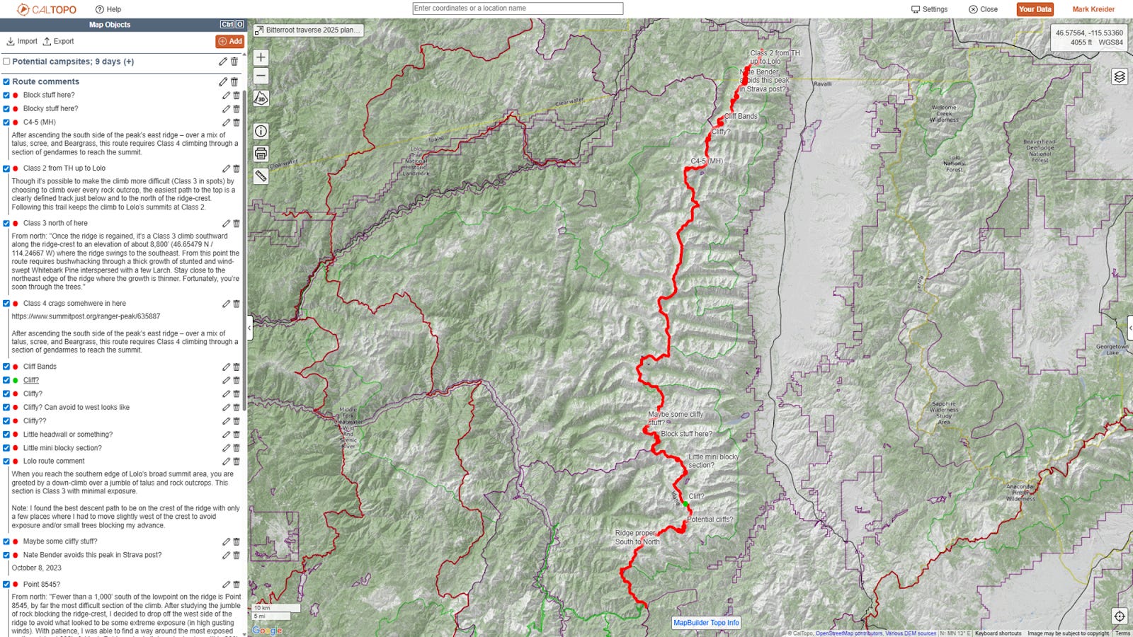
Having done a traverse of the Sangre de Cristo Range in Colorado in 2020, I immediately saw the potential for an epic ridge traverse in the Bitterroot when I moved to Missoula for grad school in 2021. However, as I began to research the possibilities, it was unclear if anyone had actually done the full route. Large portions of the traverse are often more than 15–20 miles from the nearest trailhead, and there was little to no information about significant stretches of the ridge. All I could find was this Caltopo map from an unknown user, but it looked more like planning than an actual completed route (?). Nate Bender provided some helpful beta from his own adventures on the northern ⅓ of the route. In-person scouting missions were difficult, since the ridge is generally so far from the Bitterroot Valley trailheads. Though I had intended to do a few short backpacking trips to get eyes on some of the more unknown sections, those didn’t end up happening. I’d explored peaks close to the Bitterroot Valley (Saint Mary, Little St. Joe, etc.), but had never actually set foot on any part of the Bitterroot Traverse route. With not a little trepidation, the remainder of the route planning instead came from reading the reports of the handful of named peaks along the route (e.g., Summit Post entries and Bitterroot Mountain Summits by Michael Hoyt), plus careful scrutinizing of topo maps, slope-angle shading, and satellite imagery in Caltopo.
This trip report provides an overview of the route, as well as a summary of each day, and the highlights (and lowlights) along the way. I hope it is informative for those looking to get out on their own adventures in the Bitterroot, or provides inspiration and understanding of a beautiful, rugged mountain range in Missoula’s backyard.
Bitterroot Traverse Overview:
The route I completed covered 130 miles and 58,695 feet of vertical gain. This includes trips off the main ridge to get water, find a place to camp, or weather/technical detours. I was joined by Josh Beisel for the first 5 days (from Nez Perce Pass to Bear Creek Pass), at which point I completed the rest of the route solo. We left a cache of food in Josh’s truck at Bear Creek Pass, so I was able to restock food and fuel at this point. My traverse took 9 days, 10 hours.
Planning:
We chose mid-July to try and thread the needle on when the route wasn’t still snow-covered, still had enough water in high elevation tarns for easy access, and before the skies got too smoky from fire season.
To get ready for the traverse, I started training in late April. I would have liked to start earlier, but was doing physical therapy and recovering from a backcountry-skiing-incurred knee sprain prior to this. From the spring to the early summer, I thus had two and a half months of training, averaging about 25 miles and 6,200 feet of vertical gain a week. Most of this came via trail running, plus weighted hikes up Sentinel, the local mountain that presides over Missoula. This was less than I had hoped, and I went into the traverse attempt somewhat uncertain of how my body would hold up.
Other planning included reading books: Forty Years a Forester by Elers Koch, Remote by DJ Lee, The Lochsa Story by Bud Moore, Indian Creek Chronicles by Pete Fromm, and The Bitterroot & Mr. Brandborg by Frederick Swanson. Learning about the Bitterroot and a little of its history greatly added to the enjoyment of the trip; I would also love to learn more about the history of Indigenous peoples in the Bitterroot, especially use of and travel in the high alpine sections.
Food planning
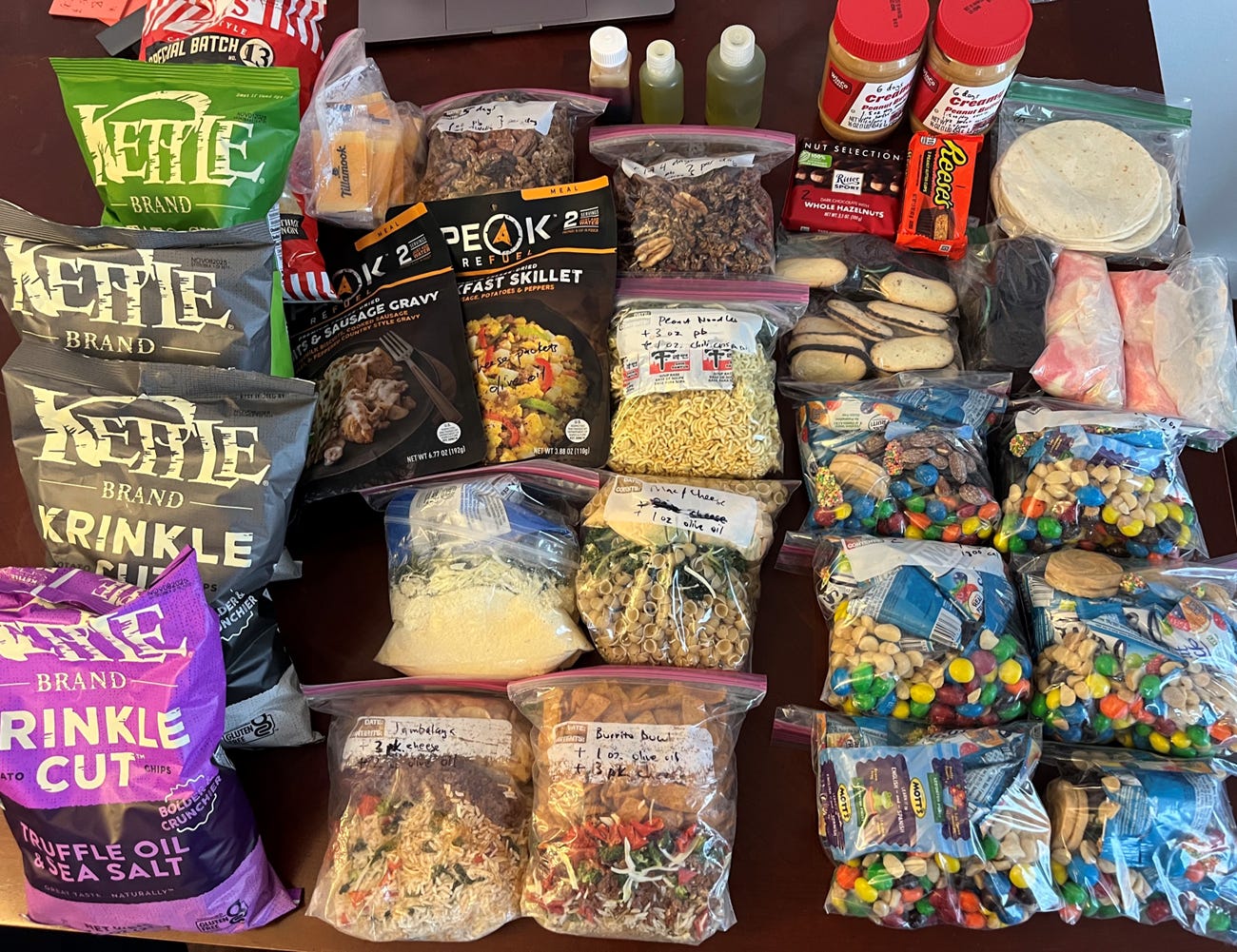
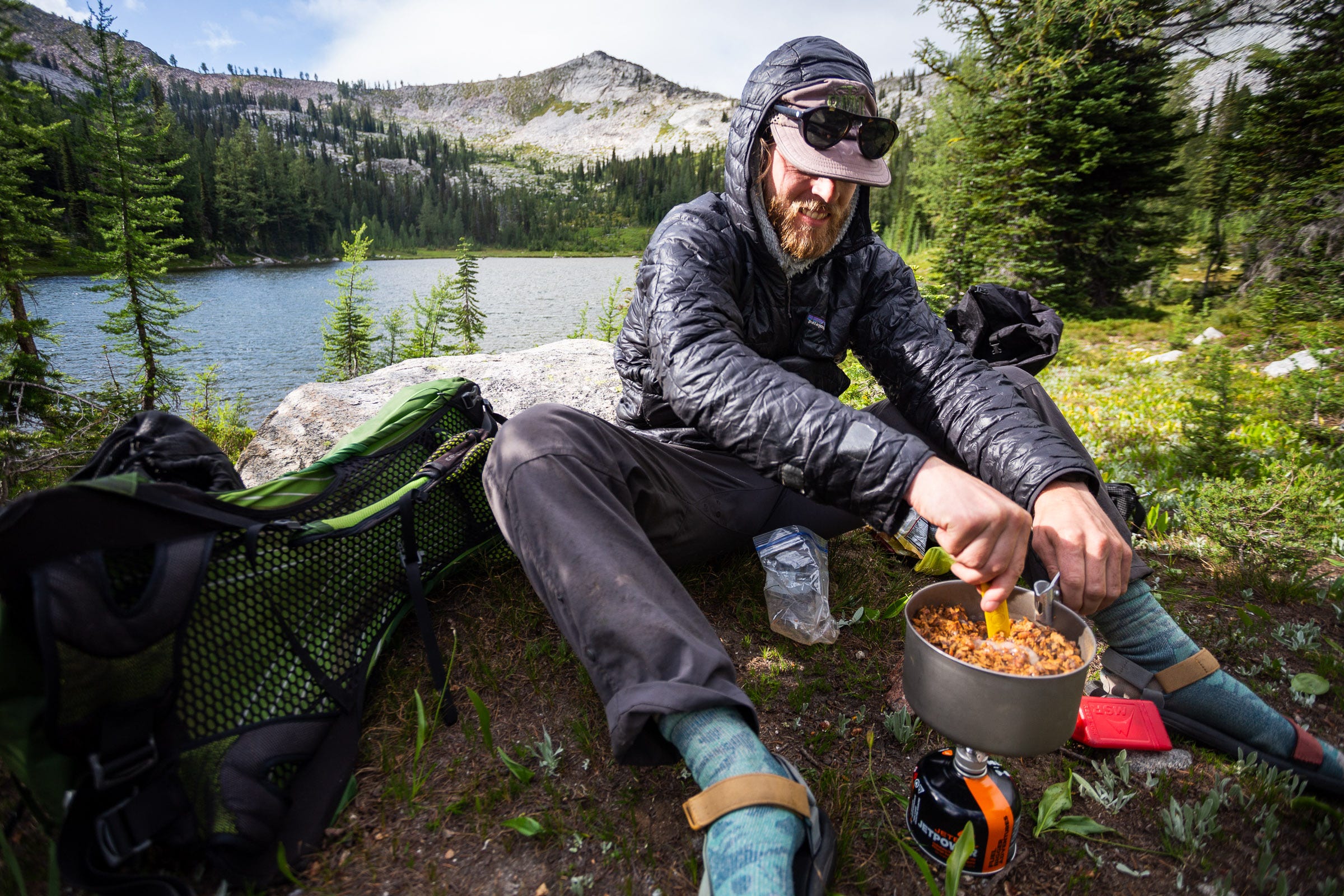
I try to pack food that is delicious, efficient (i.e., high calories / ounce ratio), and that has variety to keep from getting tired of food over a week+ adventure. For me, food is a huge motivator during a hard day or under poor weather conditions; because of that, I’m willing to carry a bit more weight (i.e., a small stove) to have hot, tasty dinners to look forward to. For this adventure, I planned ~4000 calories (29 oz) per day, knowing that that wouldn’t be enough, but carrying any more weight would be prohibitive. I dehydrated and assembled all but one of the dinners; you can save a lot of money, make higher calorie dinners, and it’s fun to prep! See my food spreadsheet here.
Gear List
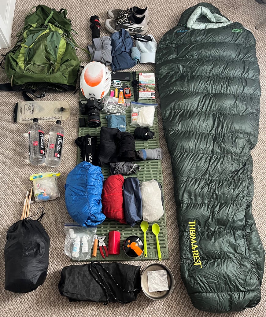
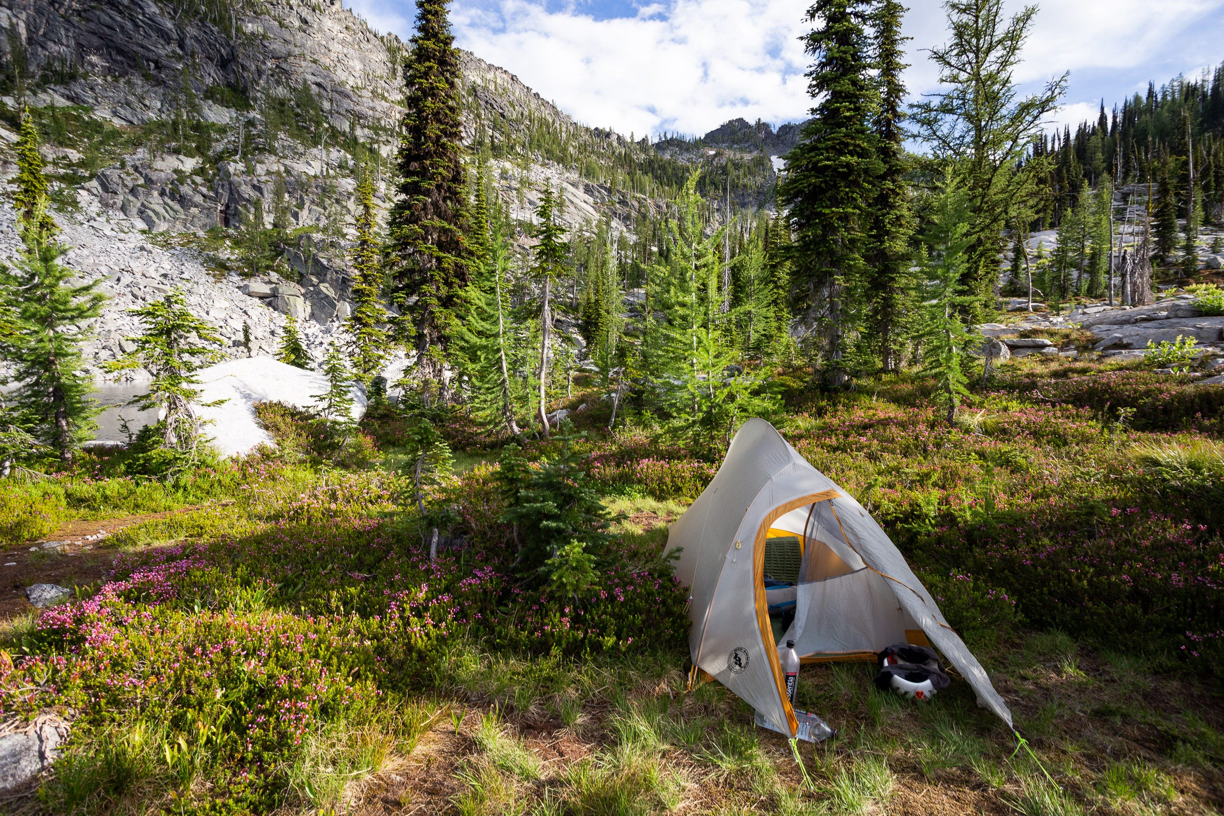
Base weight was 11.4 pounds, although I opted to bring my (heavy) camera gear because I love taking photos; that added a little over 3 pounds. For the first half, Josh and I shared a 2-person tent, a 1.6L pot, and all other group gear, helping to reduce weight. For the second half when I was solo, I switched to a 1-person tent (bugs were bad, and we agreed a tarp would not be very fun), a smaller pot. Total pack weight with fully topped-off water and 5 days of food was ~32 pounds. See my gear list here.
Day by Day Report
Note: Because there are very few named peaks on the route, I have included several references to unnamed peaks (i.e., Peak 8368), with the referenced elevations coming from the USGS scanned topos on Caltopo. See the GPS tracks and Caltopo map here.
Day 0
After picking up some pizza and salad from Bridge Pizza, Josh and I left Missoula in the afternoon, each driving a vehicle. We drove the 2 hours to Lost Horse Pass, where we left Josh’s truck, with my food for the second half. After making sure that we weren’t leaving behind any important gear, we got in my car and drove another 2 hours to Nez Perce Pass, digging into supper and getting extra stoked for our adventure. At Nez Perce Pass we stretched our legs and admired the expansive country, with the Frank Church River of No Return wilderness to the south, and the Selway-Bitterroot Wilderness to the North. We got an early bedtime, ready to get up before sunrise to begin.
Day 1
17.2 miles | 6293 feet gain | 10:13 hours
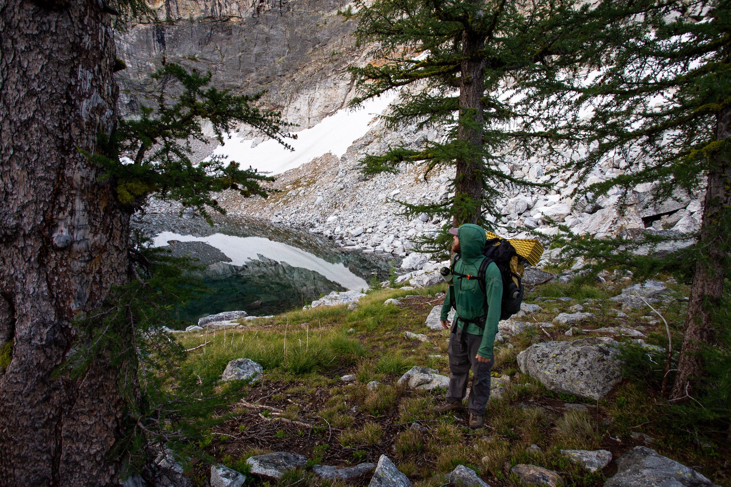
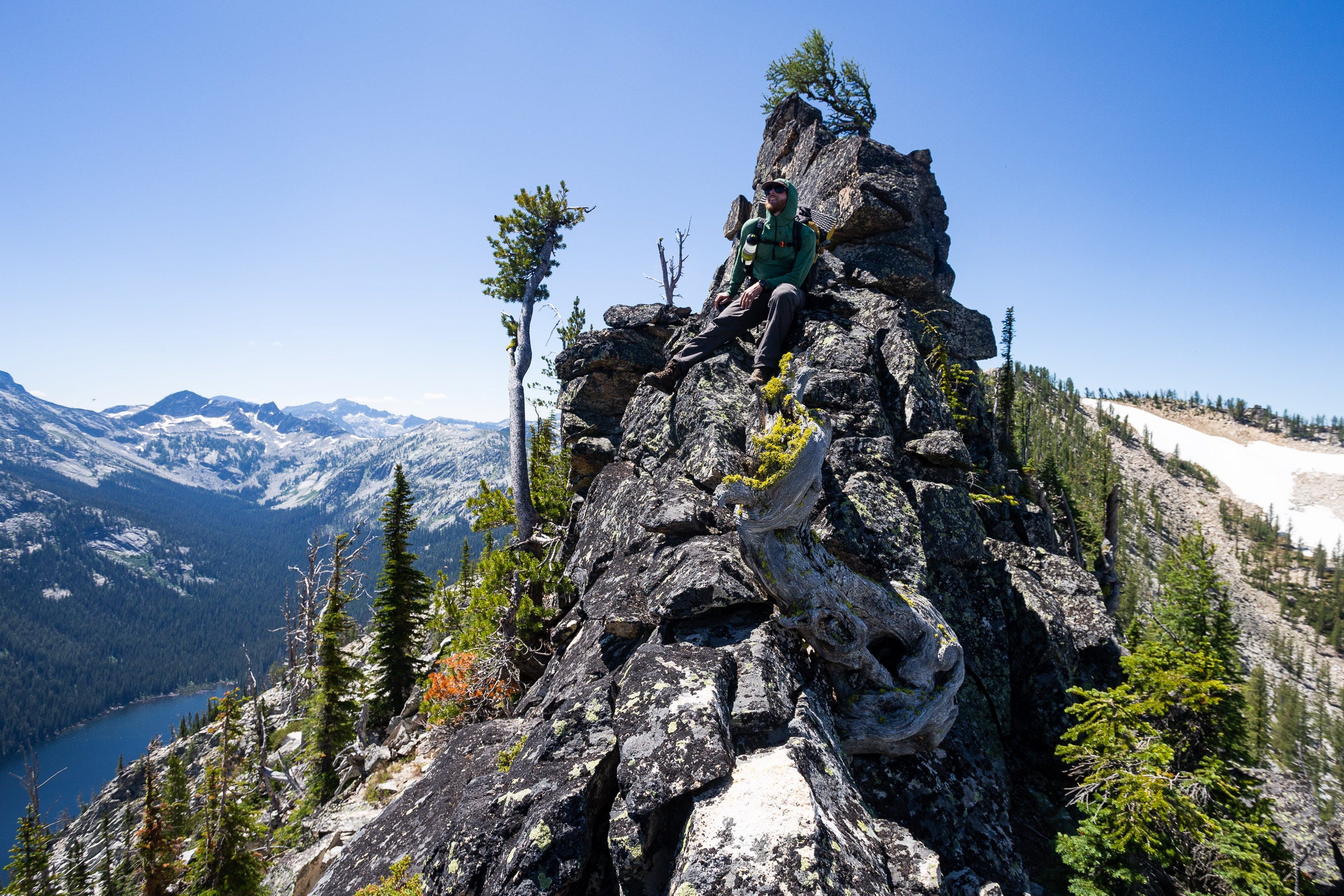
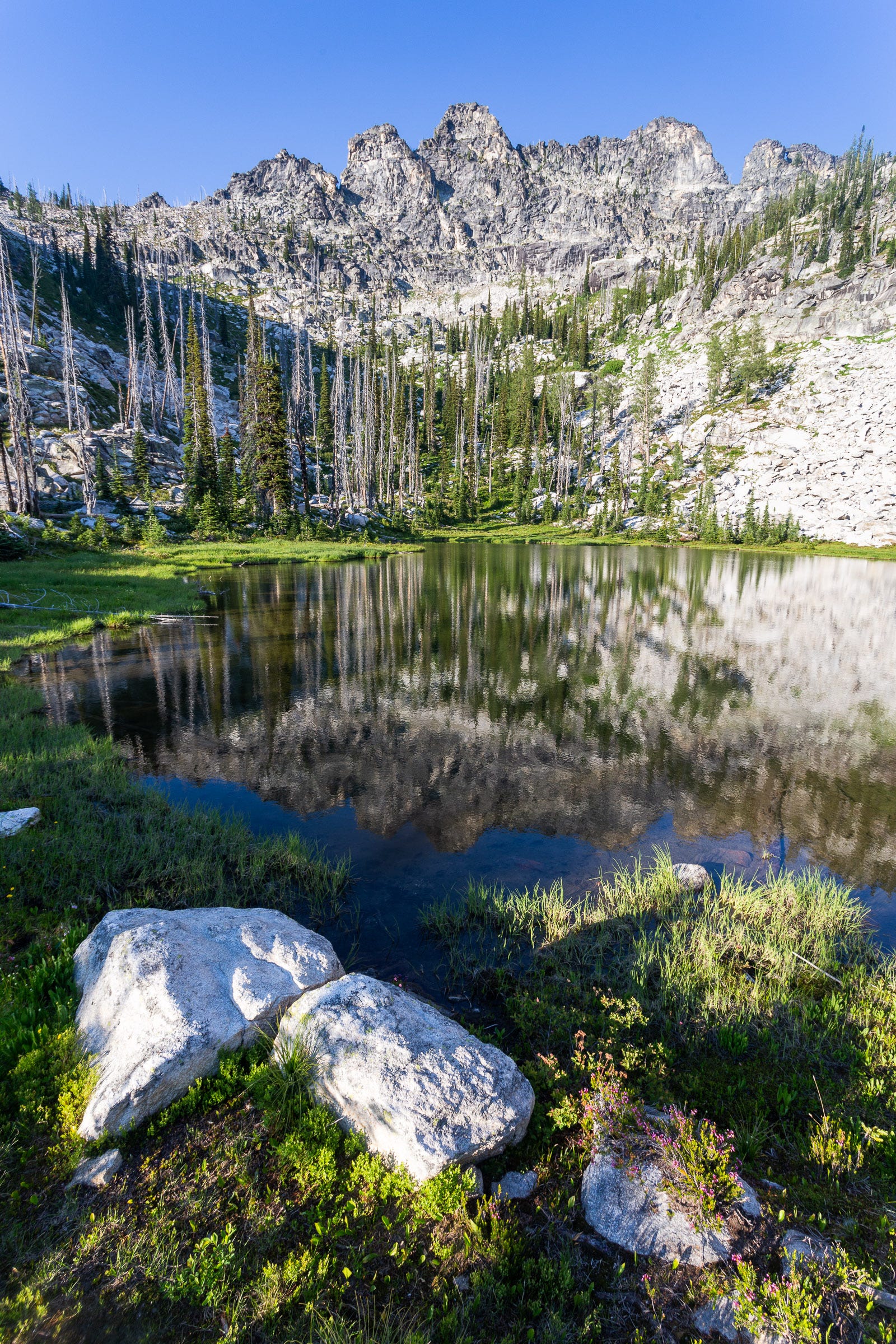
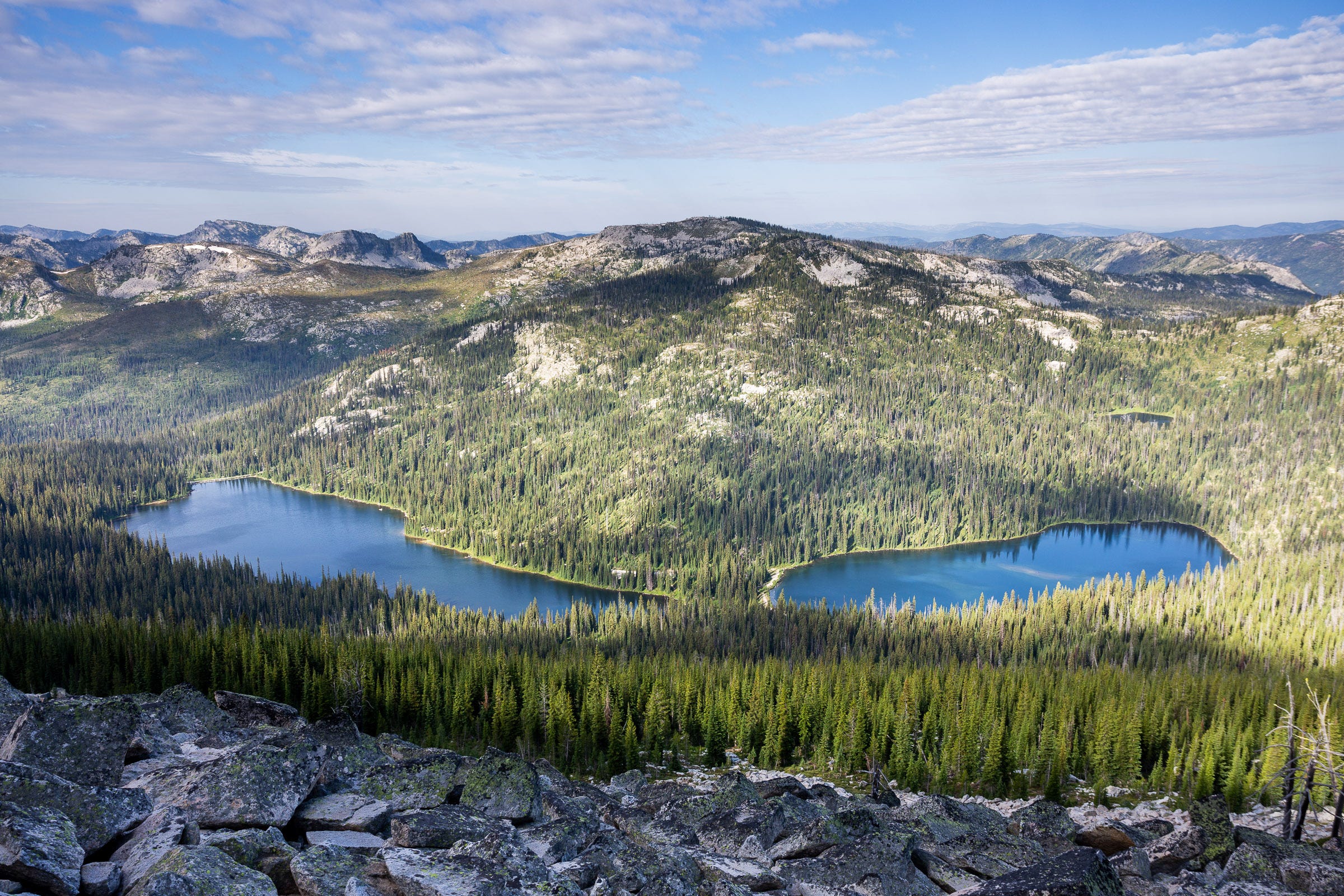
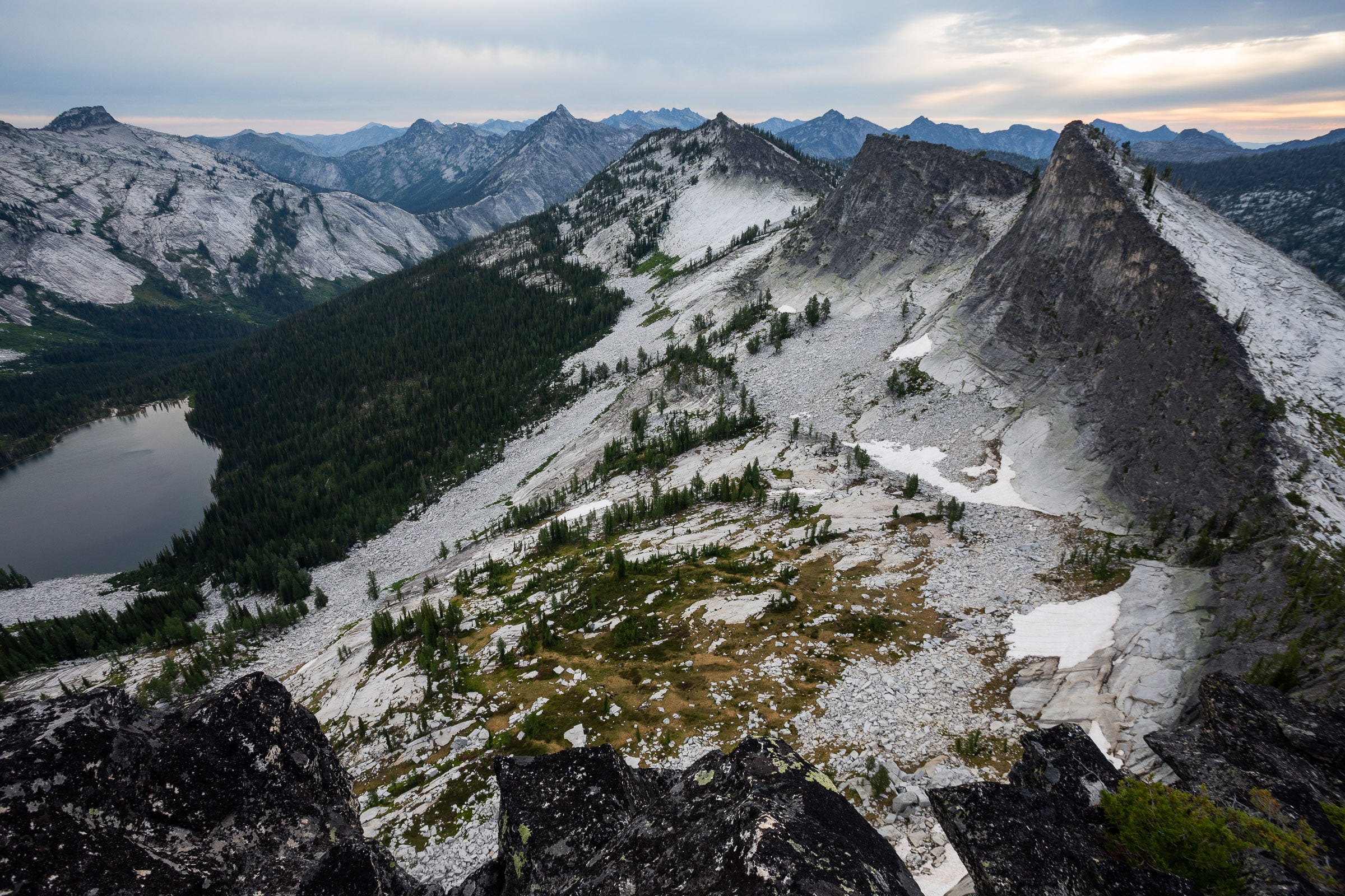
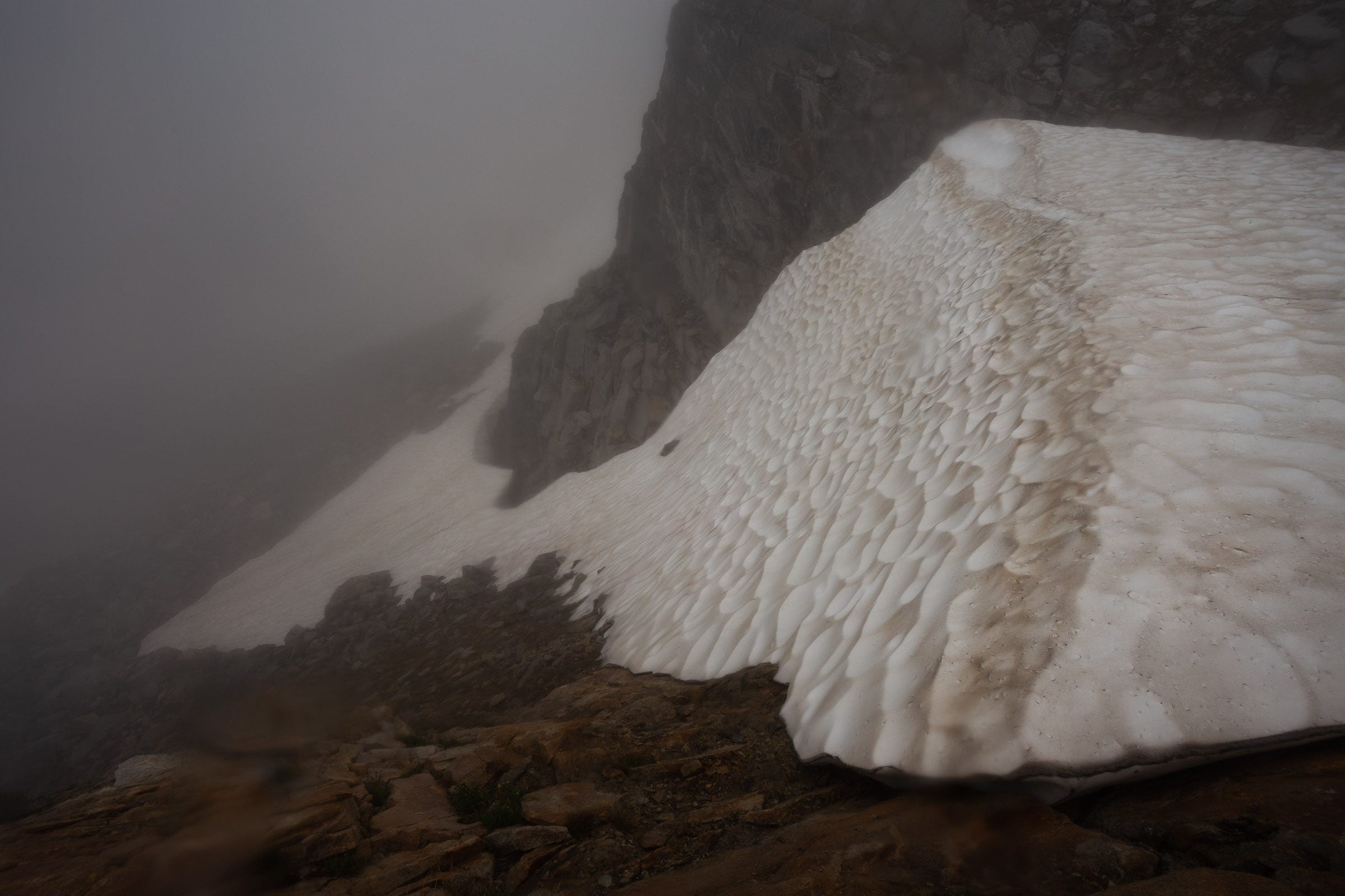
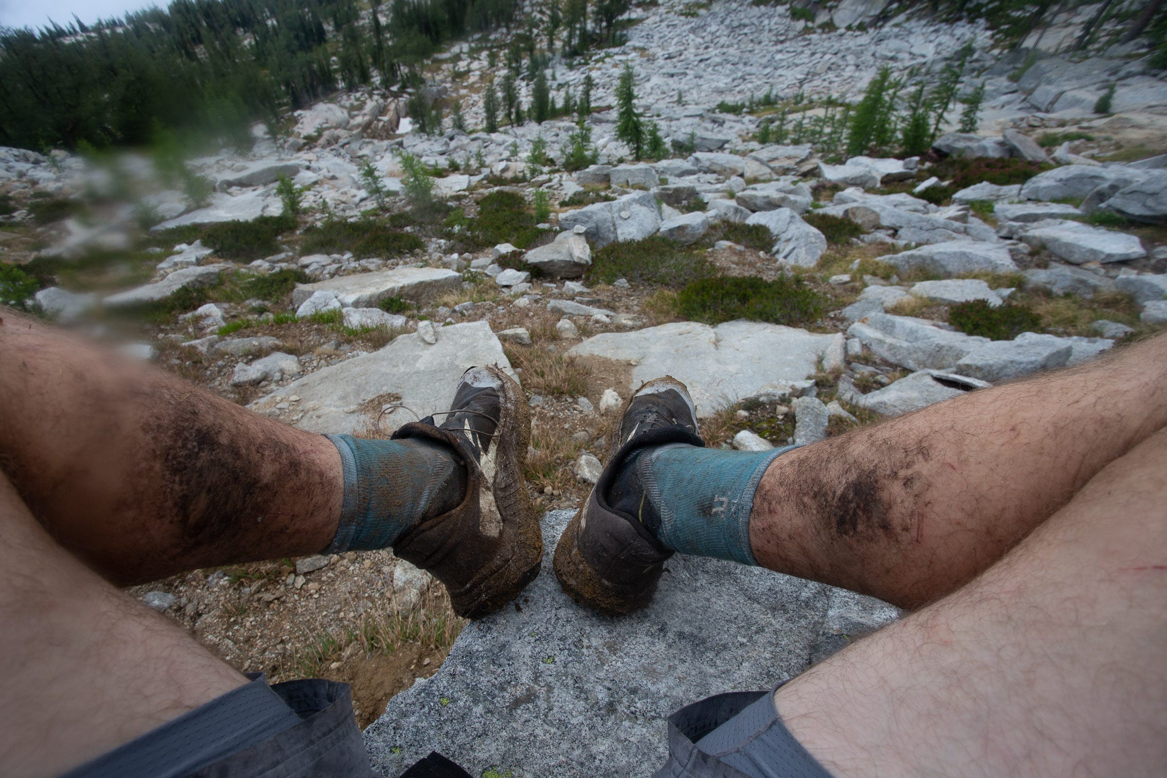
We set off at 5:24 AM (the ridgeline is also the border between Mountain Time and Pacific Time, I’ll use Mountain Time throughout), eager to cover good ground on some of the only trail portions of the route. We made good time on the Old Nez Perce Trail, following the ridgeline as the sun rose and we started to get glimpses of some of the first Bitterroot peaks to the north. After 7 miles, we departed the trail and began hiking up a steep forested and then grassy slope towards Indian Hill, the first named peak on the route. Once on the ridge, the next 8 miles are easy going, mostly Class 2 travel across grass and talus, with the occasional class 3 section. The biggest challenge here was the heat; on the exposed ridge the sun beat down on us and we frequently would stop at remnant snow drifts to gather some snow to stick under hats and on our necks. The day’s highpoint of Watchtower Peak gave good views of the first scrambly bits of the route. We descended to camp at Watchtower Lake. After a quick swim in the lake, we quickly ate supper and gladly got in the tent, grateful for the mesh keeping the hordes of mosquitoes at bay. We went to sleep happy with the day’s progress and glad we weren’t feeling too sore, even with the heaviest pack weights we’d have, on one of our bigger days backpacking to date.
Day 2
11.5 miles | 5167 feet gain | 9:57 hours
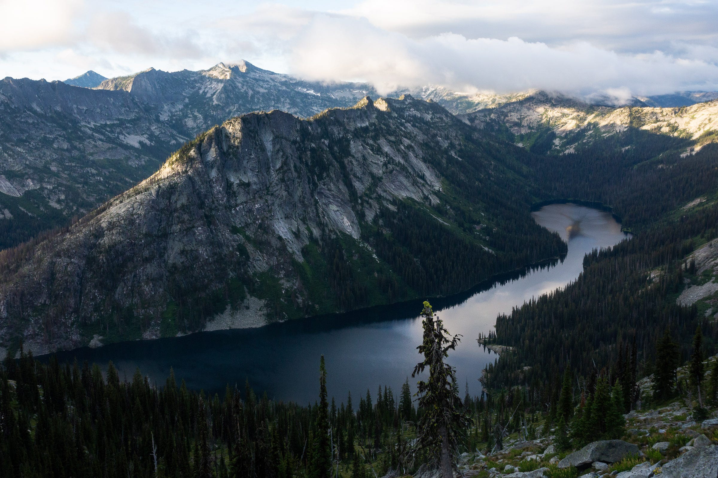
We woke up in the dark and started hiking at 5:20 AM. With headlamps and a partial moon above us, we quickly gained the ridge again, and were treated to a delightful, scrambly section of ridge for the next half mile, with dawn views of lakes to either side; Watchtower Lake to the south, and an unnamed, gorgeous lake to the north. We entered a little cirque that had been hidden from the valley below. We were compelled to make a quick detour off the main route to go explore a little tarn nestled in the bottom of the rocky amphitheater. Surrounded by old growth larch trees, we decided that the tarn would make a magical campsite for a future adventure, perhaps including an ascent of Mount Jerusalem.
After we had tanked up on water for the day, we returned back to the main ridge, and navigated some blocky seams on the downclimb to the next saddle. The next mile and a half were fairly mellow across talus, with great views down into the Little West Fork valley. We saw evidence of cut trees and stumps on top of the ridge, with charring from a very small fire—from smokejumpers perhaps? A fire in this location would be miles from the nearest trail and pose little danger, so it remained a mystery.
We were anxious to reach Point 8922, which would give the first unobstructed views of the ridge leading to Bare Peak Northwest. This stretch of the ridge was the most uncertain of the whole route for me—a 3 mile portion with very steep slopes on both sides and lots of cliffy gendarmes from the looks of the satellite imagery. We had no beta on this portion, and so any attempt would necessarily have to head in blind. Add to that, once committed to this stretch, there were no good bail routes and the forecast for that day had a change of lightning in the afternoon. After discussing it from our high vantage point, we decided we didn’t want to get stuck in something that might take far longer than we planned, especially in an exposed location with no certainty that the ridge would “go”.
Instead, we dropped into the valley just to the North of Point 8922, bushwhacking our way across to Canyon Lake, and then regaining the ridge where it dropped into a relatively flat, forested plateau north of Boulder Lake. Over the couple hours after we started our detour, the sky got much more ominous and we didn’t regret our choice. For those wanting to do as “pure” of a traverse as possible, I would recommend scouting this section before starting the full attempt.
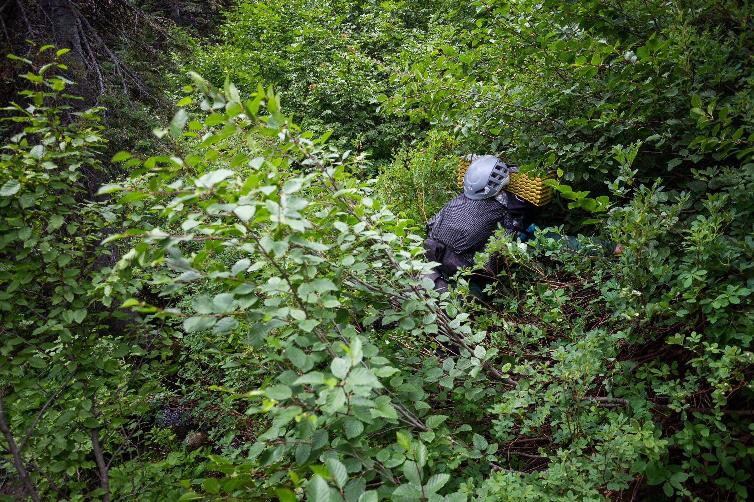
At the saddle where Trail 617 and Trail 2 meet, we again took stock of the weather. With significant cloud movement and more building, we decided to take a lower elevation route to our goal campsite, at lakes at the head of Canyon Creek. This portion of the ridge looked like it would be nice though (perhaps with the exception of some big cliffy sections to the west of Trapper Creek Peak). Saving that section for another adventure, however, we descended on Trail 2 to the west for 1.5 miles before beginning a bushwhack up Canyon Creek valley. Here we encountered some first class Bitterroot Bushwhack, which strangely delighted both Josh and me, as we had spent a summer together conducting field ecology research in the Selway portion of the wilderness, and it brought back fond memories of even more heinous interactions with the shrubbery. Finally, we arrived at the unnamed lake basin, rather tired, but pleased to set up a lovely campsite in the open larch forest in between the two lakes. The chili mac did not stand a chance.
Day 3
9.7 miles | 3694 feet gain | 10:04 hours
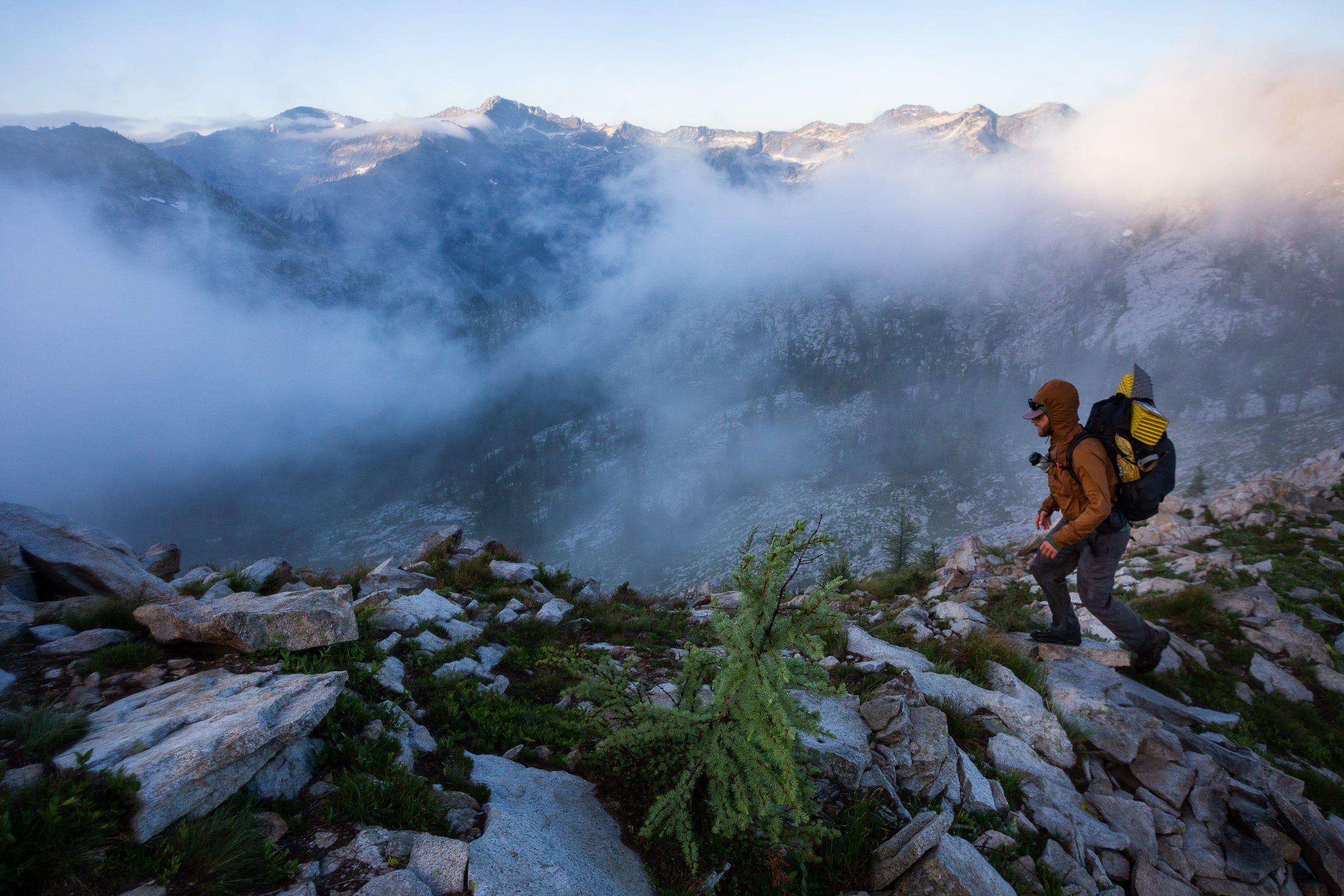
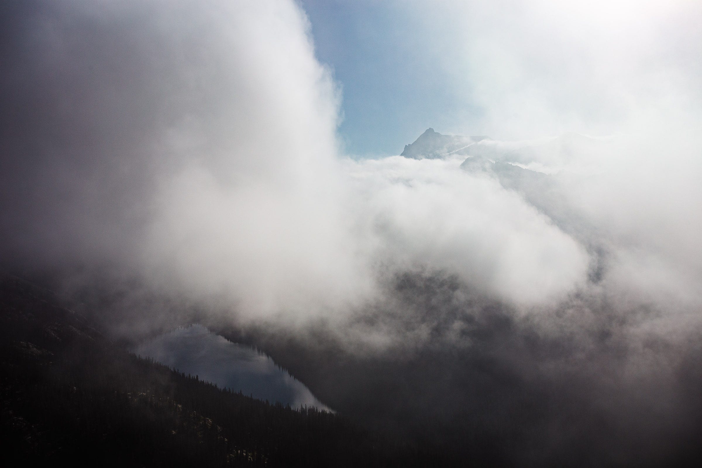
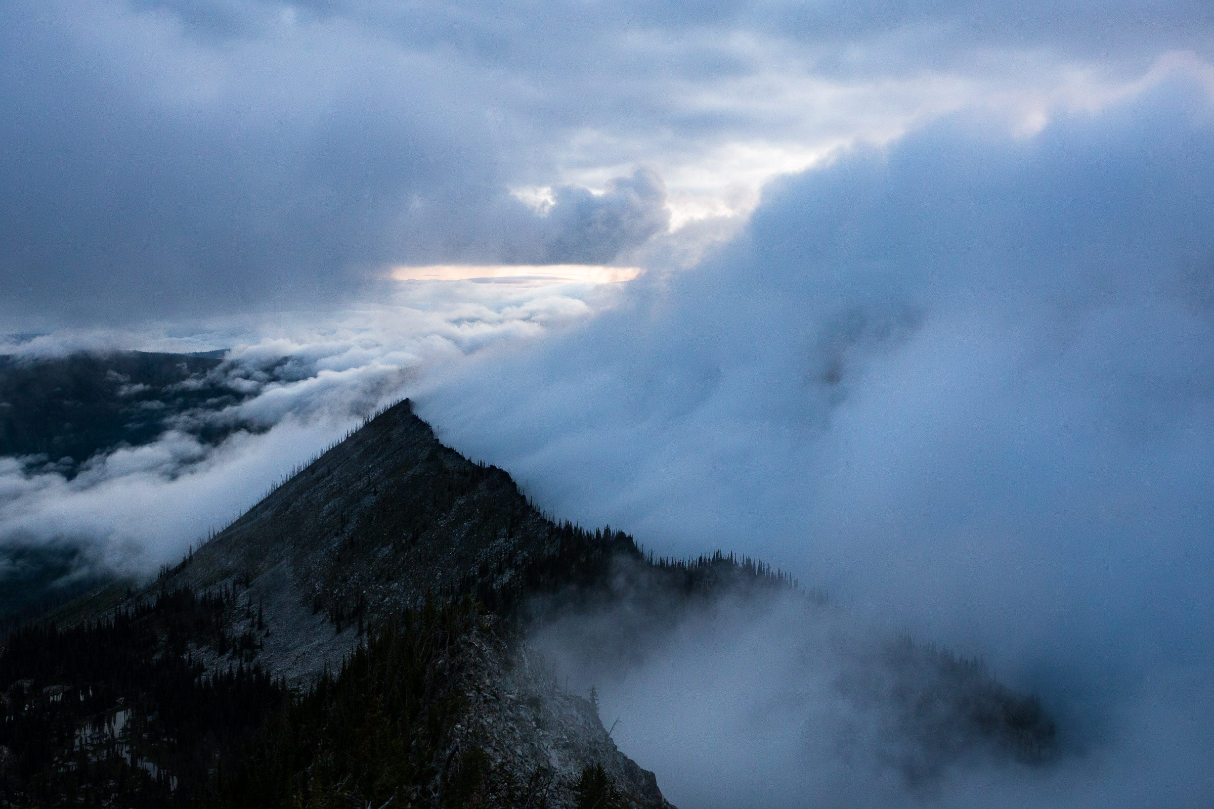
We woke up to a misty, cold morning. The soreness from the preceding day’s journey was starting to accumulate, but we got off to a good start, hiking by 5:50 AM. We quickly gained the crest again, and were treated to beautiful views of clouds rolling off the ridge.
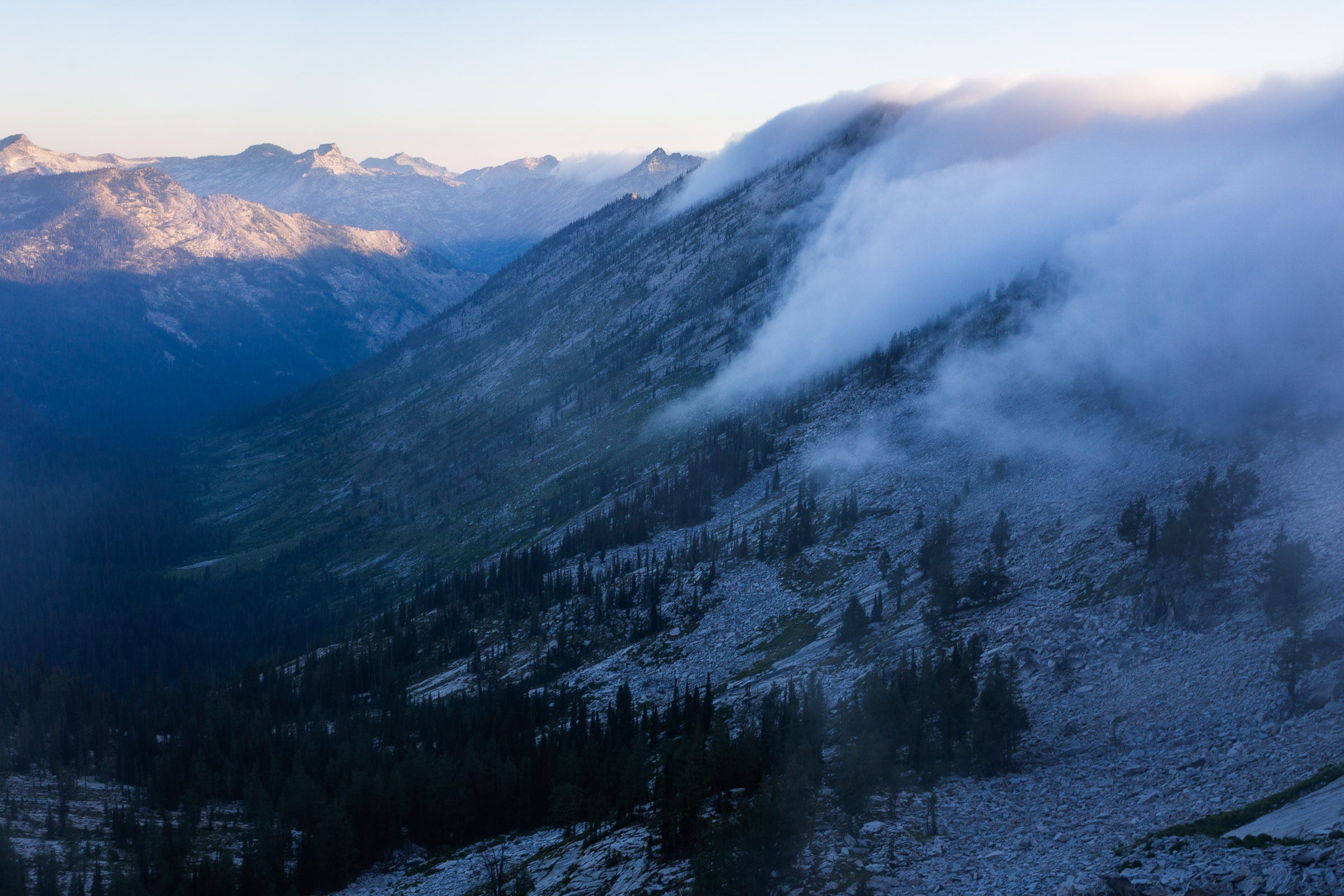
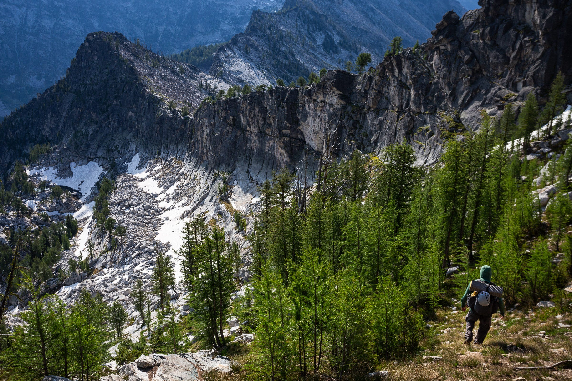
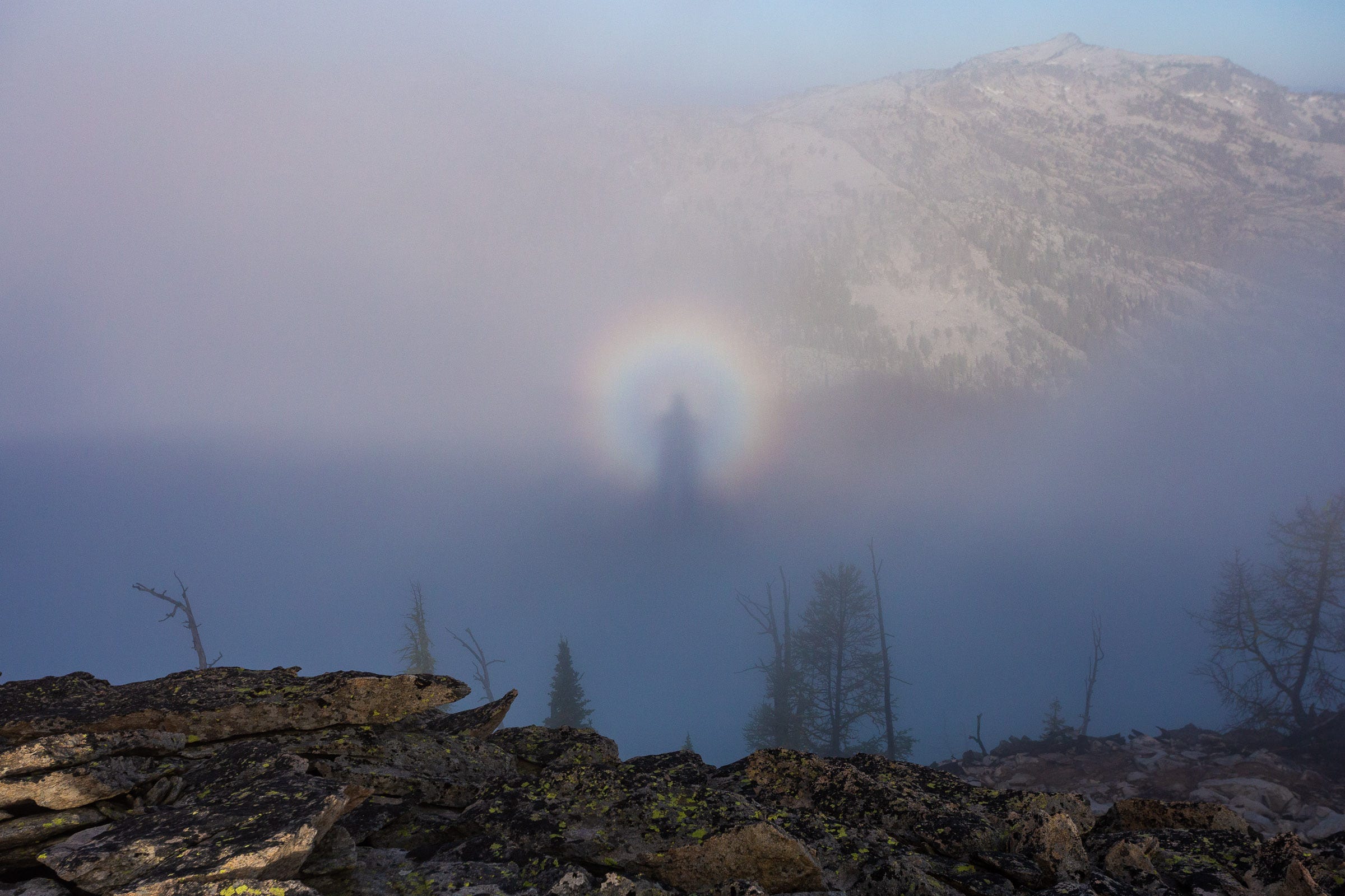
The next 3.5 miles were some of the most spectacular of the whole traverse. Relatively mellow talus made for fun travel, interspersed with moody, old growth larch groves. We would go in and out of the mist, with the large peaks (The Shard, Sugarloaf) to our east continually revealed and then hidden by the billowing clouds. We also were treated to a Brocken spectre, before the clouds finally cleared by about 9 AM.
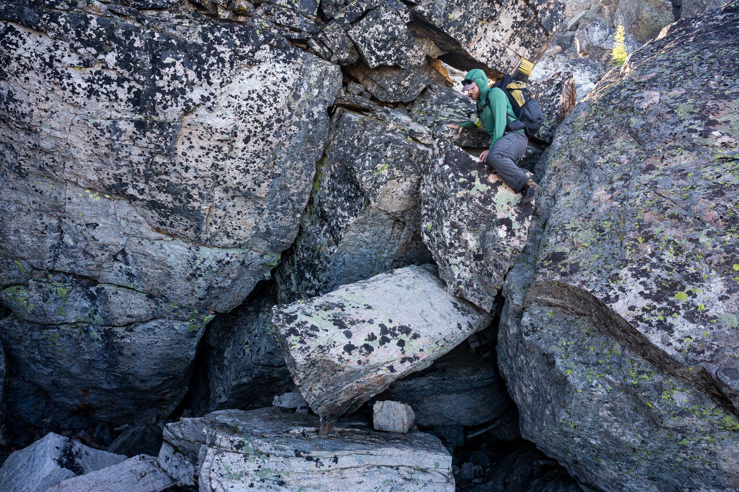
At the saddle to the west of Tin Cup Lake, we dropped down about a third of a mile on Trail 96 until we found a little stream to refill our water bottles. Replenished for the day, we continued back on the crest for another mile until we hit the first 4th class scrambling of our journey. We traversed across a steep slope, dropping just off the ridge to the north to avoid a large cliff. We reached a saddle at 8360’ and stopped for a rest in the shade. Josh’s knee was starting to hurt a good bit, and so we elected to take a more direct route through a high plateau just off the main crest to the west. This detour also avoids what looked like certain Class 5 climbing—this portion (around Peak 8368) would be wise to scout if you are interested in doing the literal ridge.
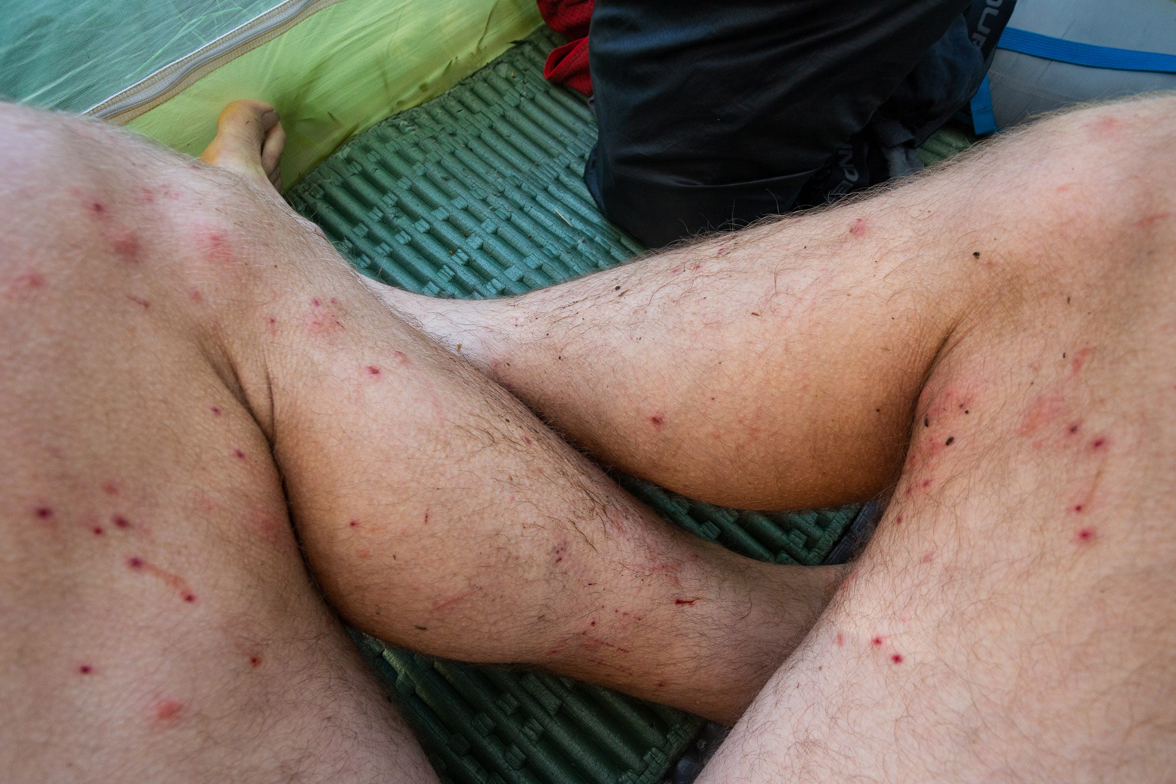
Josh’s knee continued to get worse, and the hot, exposed plateau felt like it took far longer than it actually did. Shortly before dropping into a small lake (~7250’) to camp, we startled a group of about 8 male elk resting in the shade. The elk tore down the valley, covering in 30 seconds what would take us 30 minutes. The area surrounding the lake had been burned in 2007 and still had very little shade, but plenty of mosquitoes. Pitching our tent by the largest bush we could find, we quickly jumped in the cold lake, hoping that the ice bath would help recuperate our legs.
Day 4
8.6 miles | 4072 feet gain | 8:57 hours
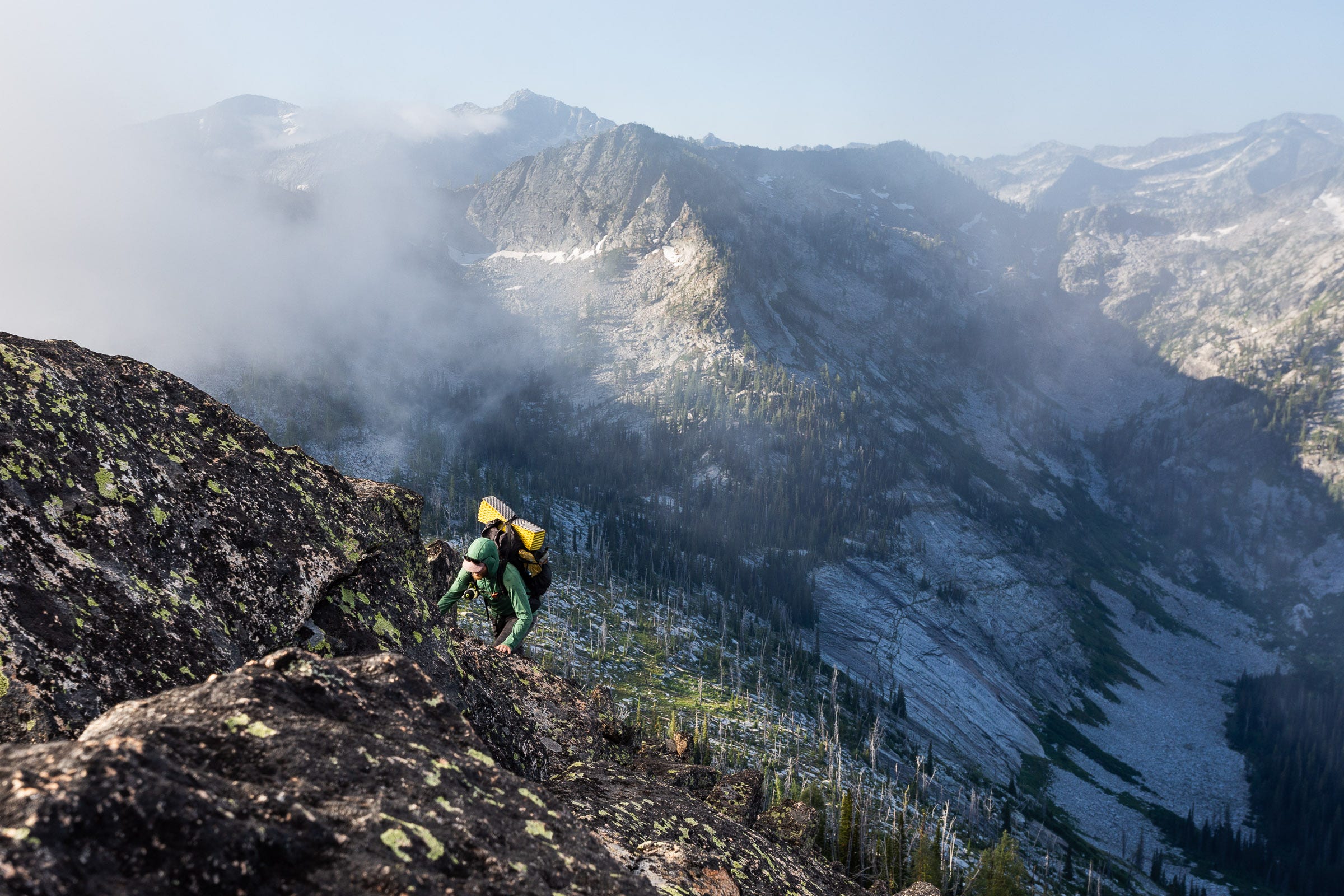
The cold soak, plus a good night’s rest, seemed to do the trick, and Josh’s knee felt better in the morning. Heading off just after 6 AM, we continued west back up to the crest, enjoying the sun’s warmth as it rose over the back side of El Capitan. A section of large boulders—some the size of large vans or small buses—made for some fun and creative routefinding.
We came to a saddle that marked the start of a large horseshoe bend in the ridge. Judging from the map, there would be a good bit of blocky, and potentially cliffy portions to navigate. By this point in the day, we needed more water and lacking any beta on the ridgeline, we decided to detour this horseshoe portion, instead cutting straight down into the valley and then back up the other side.
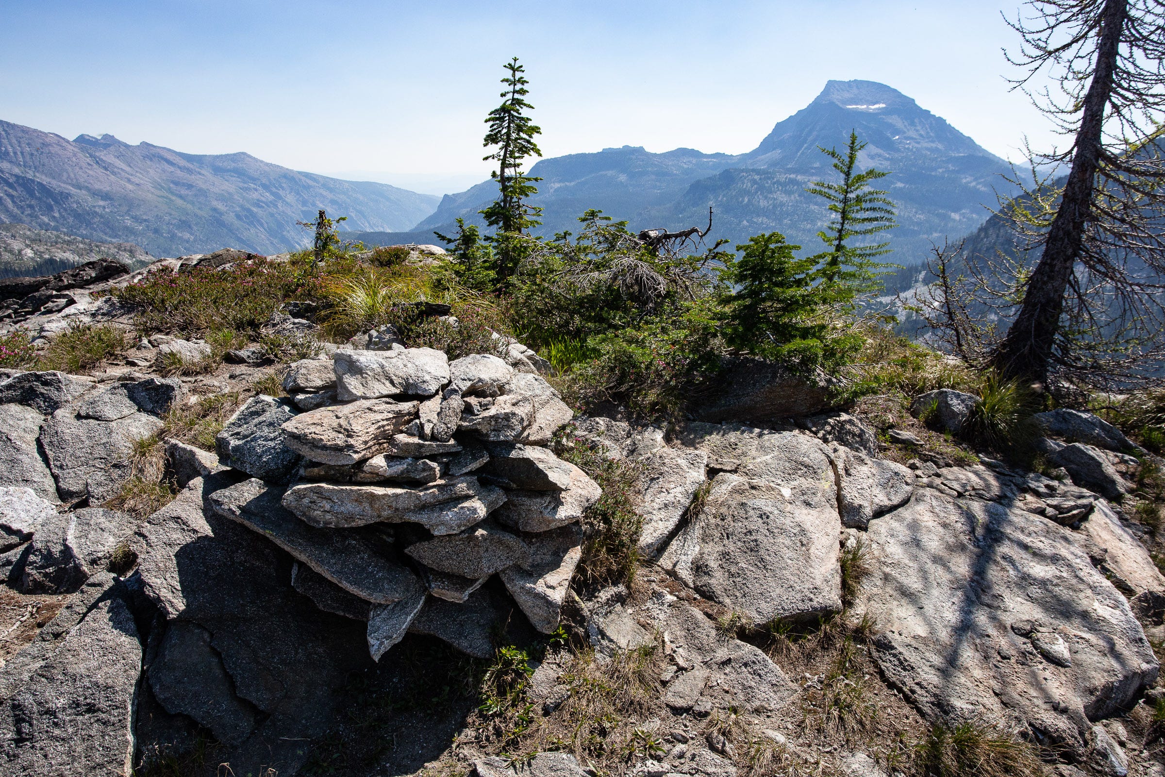
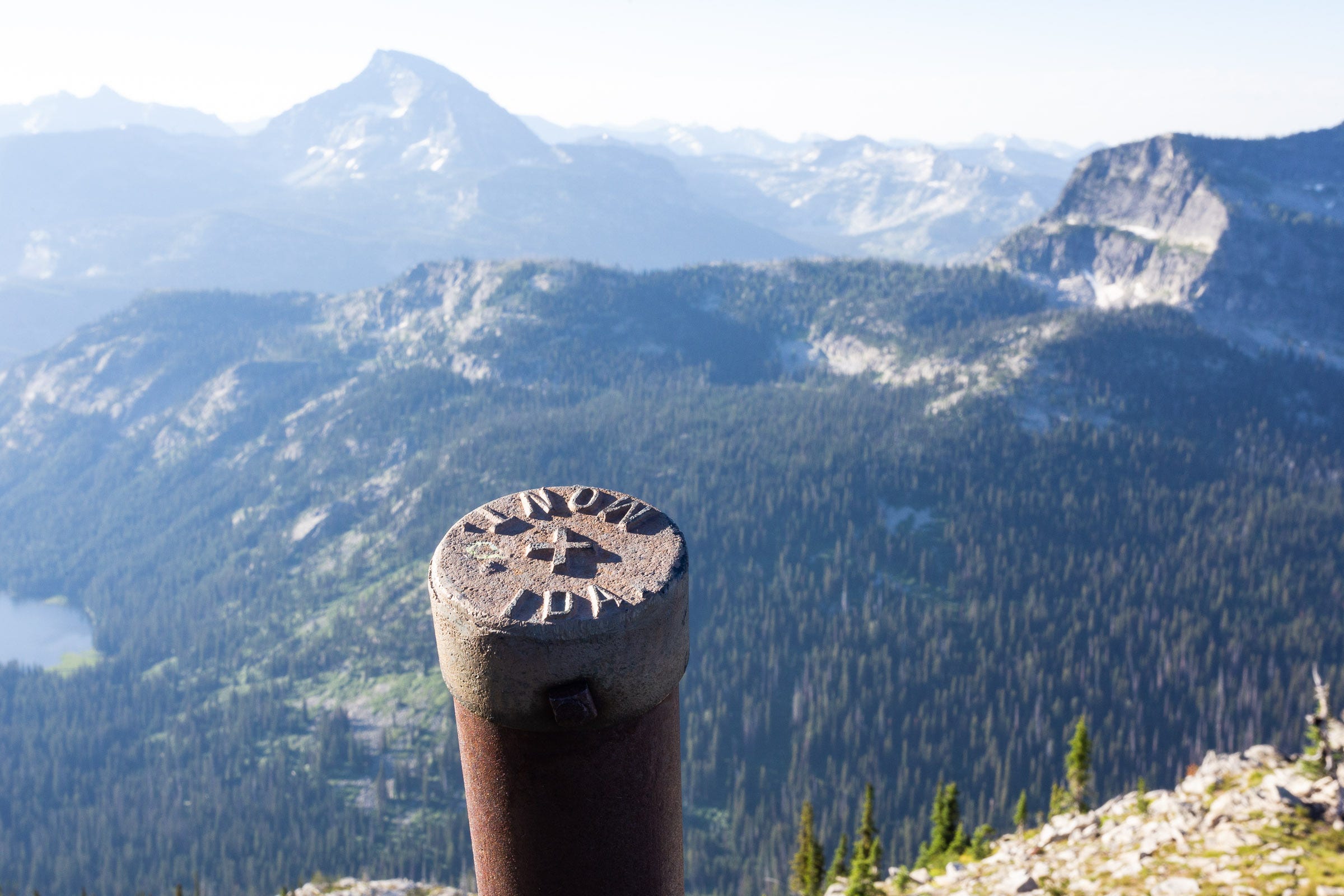
Back up on the ridge proper, we stopped to eat lunch and enjoyed seeing another instance of what had become a familiar sight: a rock cairn in a very remote location (at least 4 miles from the nearest trail). As I later learned, these cairns—and metal mileposts—were likely placed well over a 100 years ago, during the 1904–1906 survey of the Montana-Idaho border. We wondered who else had been here since then.
Once again the hot afternoon sun was taking its toll, and we cut up to the next saddle, before descending into the Grizzly Lakes basin to camp. After getting cliffed out on two occasions, we finally found a route down to the thick brush and buggy area surrounding Little Grizzly Lake. As we wolfed down a hearty cheesy mashed potatoes, we reflected on the miles we had come to get here, and figured that we could probably get to Josh’s truck the next day, meaning that, sadly, tomorrow would be Josh’s last day out on the crest.
Day 5
9.5 miles | 4091 feet gain | 8:11 hours
The last day of the first half started with the energy and anticipation of knowing that we had extra food and drink awaiting us in Josh’s truck, some 10 trail-less miles away. With packs lightened from the previous days’ food and fuel consumption, we made good progress on the crest, enjoying relatively mellow terrain and lovely views down into alpine lake valleys that we made mental notes to return to on future overnight trips.
We descended through a lovely, mellow grade larch forest to the saddle between Upper Bear Lake and Fish Lake, and marshaled up our strength for the last summit of the day, a ~1000 foot climb to Peak 8164.
A quick descent down to Bear Creek Pass deposited us at the truck by 2 PM, were we quickly tucked into some BodyArmor sports drinks, still cold in a Yeti cooler five days after we had left them.
We took advantage of the early afternoon hiking completion time, and drove the 3 miles to Twin Lakes. We cooled off in the lower lake, and reveled in a front country campsite. I used the rest of the day as a time for refueling, both for myself—eating ravioli, pesto, fresh green beans, cookies, chips, beer, more cookies, etc.—and for all the other gear. I re-charged my phone, headlamp, InReach mini, camera batteries, and portable charger. With Josh heading home the next day, I switched out a number of gear items, changing to a smaller tent, fuel canister, and stove. With the tasks accomplished, it was simply a joy to lean back, read a book, eat some more dessert to try and fill in the caloric deficit that we had created, and enjoy the memories we had made on the first half.
Day 6
15.4 miles | 7503 feet gain | 9:47 hours
I knew that the next miles of the crest would be relatively mellow terrain, good for covering distance. Josh was his usual gracious self, agreeing to wake up at 4:00 AM and drop me back off at Bear Creek Pass where we had finished hiking the day before. After saying goodbye and thanking Josh for a wonderful adventure in the first half, I set off alone with my headlamp.
The gentle slopes made for quick progress, and I soon got to Wahoo Pass. Taking the trail over to Lost Horse Pass, I hiked along the edge of Upper Twin Lake, to where I had stashed several liters of water. The campground was quiet, and I didn’t see anyone at 8 AM. I turned and headed back up the slope, for a 1200’ climb back up to the ridge. Energized by the rest and refueling the previous afternoon, I felt extreme springy and covered 12 miles before stopping for lunch at noon.
By mid afternoon, I reached a small lake (7457’) on the Idaho side that seemed like a good stopping point. Checking the weather on my InReach, that the day after next had rain in the forecast, which could make ridge travel more dangerous, not to mention slow. I resolved to get a good rest that evening and make a big push the following day to get as much progress while the weather was still good.
Day 7
17.6 miles | 8373 feet gain | 13:18 hours
After a quick breakfast in the moonlit dawn, I scrambled back onto the Bitterroot Crest, intent to see how much ground I could cover. The first miles ticked off quickly, with beautiful morning light hitting the steep cliffs and peaks surrounding Blodgett Mountain.
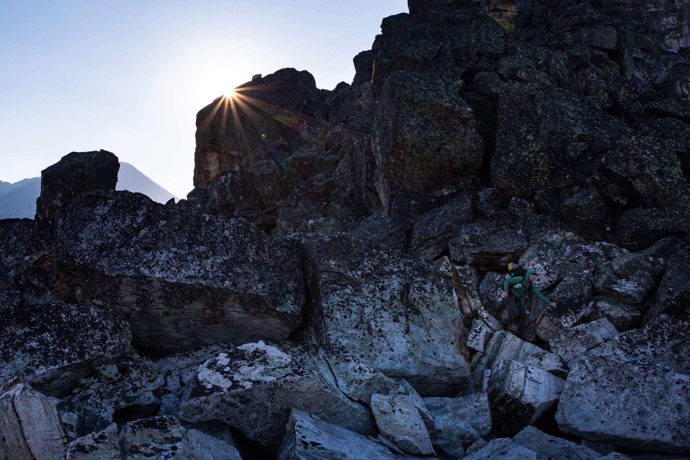
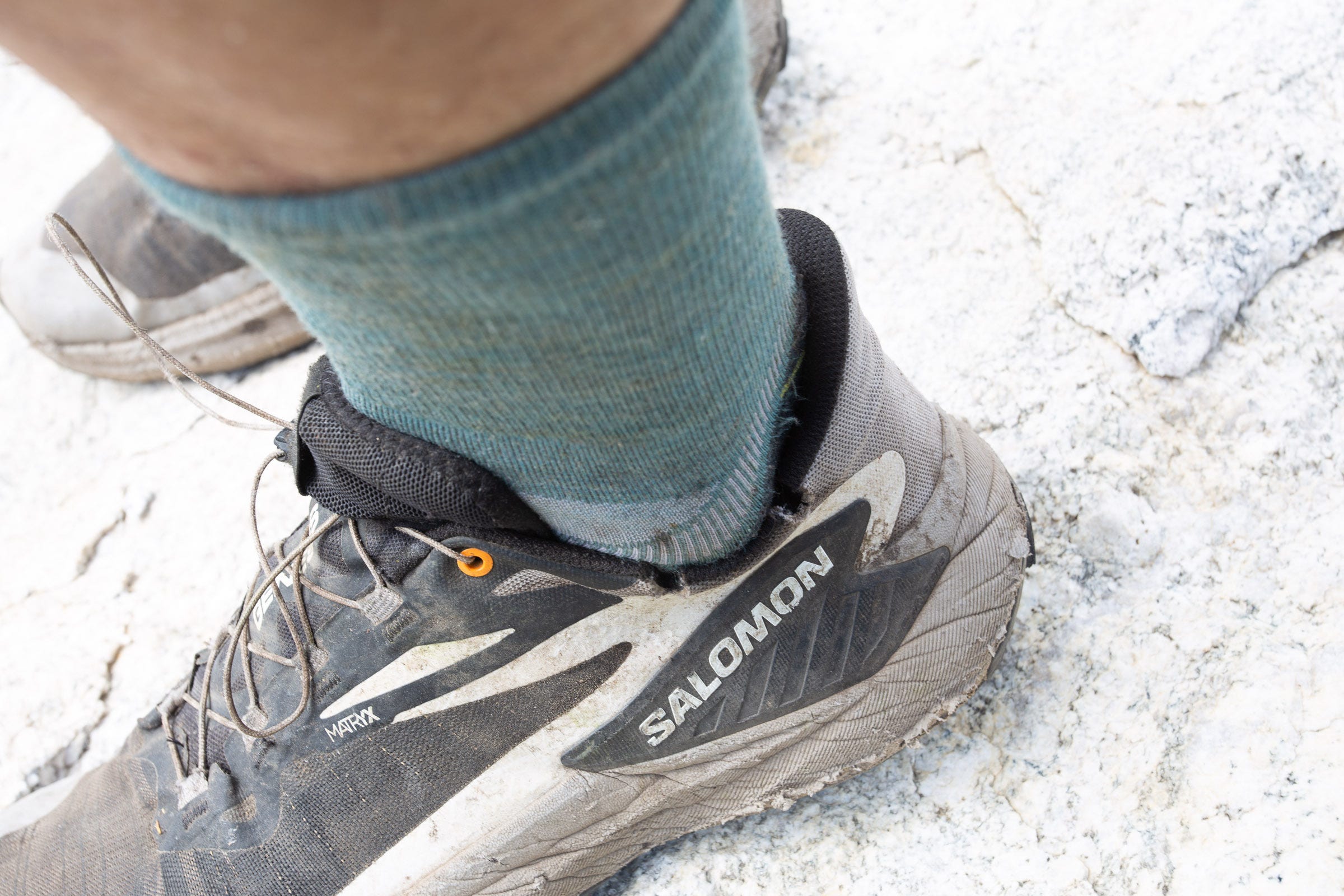
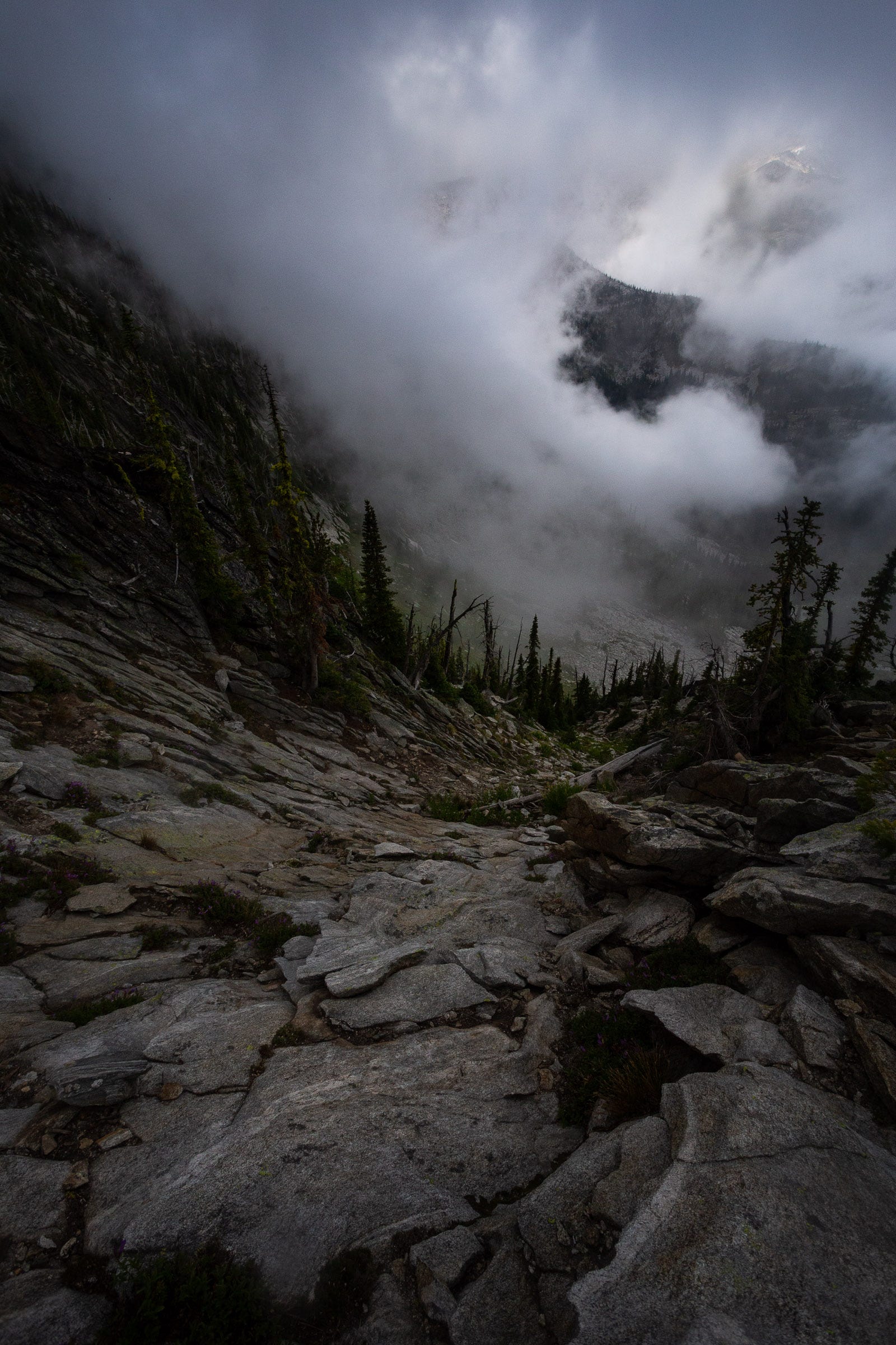
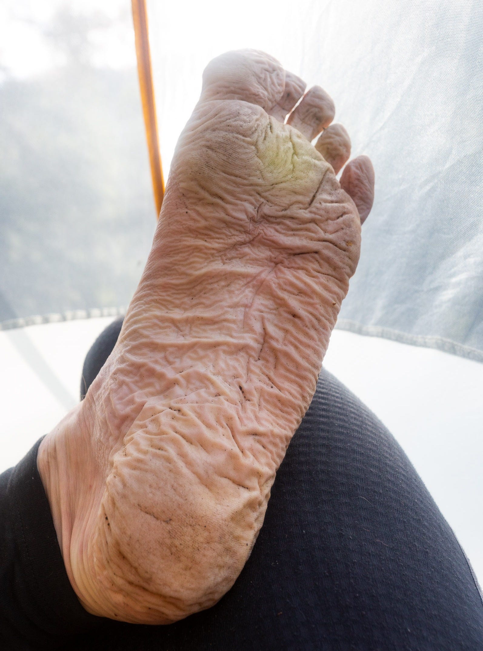
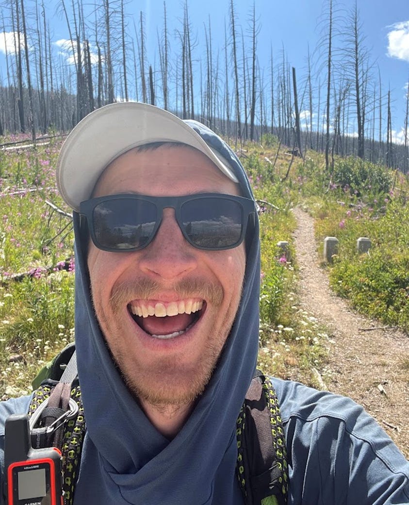
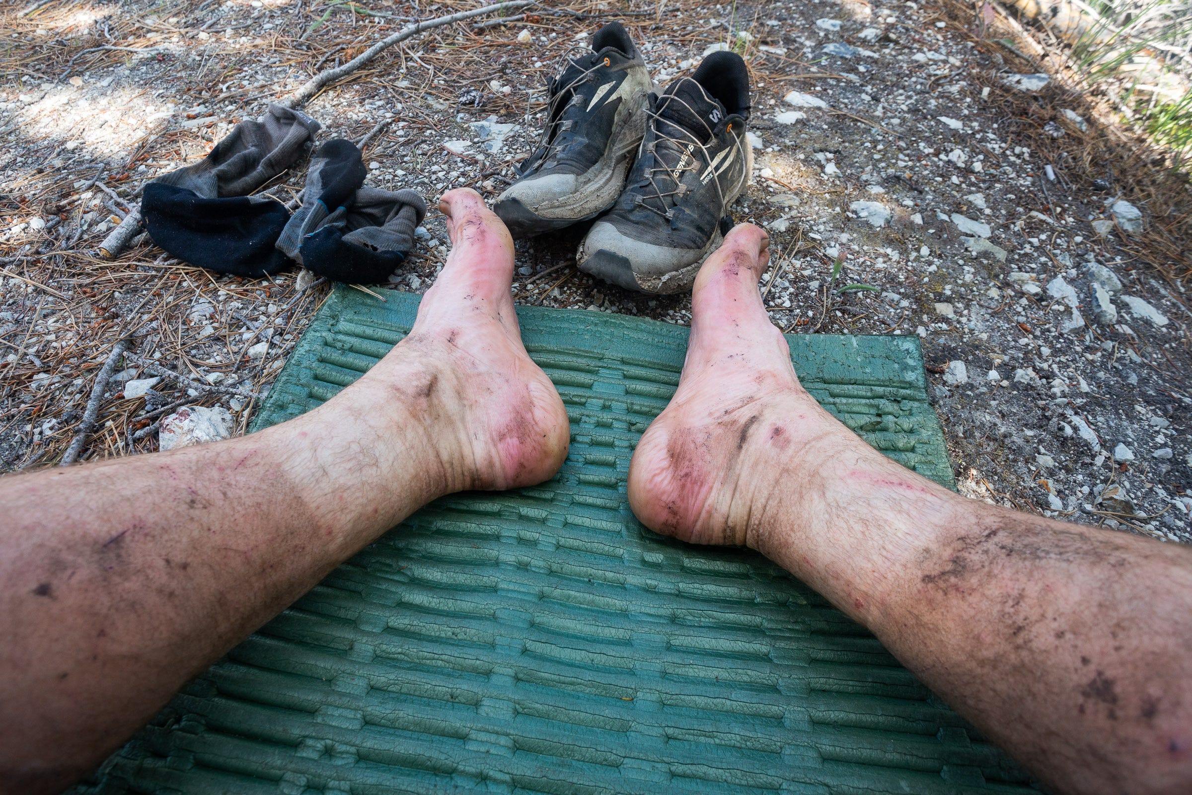
However, nearly a week into the traverse, my body was starting to feel the toll of the previous 75 miles and 30,000+ feet gain, nearly all off trail. In particular, I found myself generally choosing to walk on the Montana side of the crest, due to weather patterns that kept this side of the ridge much more open of vegetation than the Idaho (left) side. As a result, my ankles were consistently flexed in the same direction, causing my left outside ankle bone to repeatedly contact the ankle collar of my trail running shoe. While this was such a slight force that I hardly noticed it in the first several days, by this point, the bone was bruised and every step was starting to hurt more intensely. Eventually, I decided that my shoe needed a pressure-relieving surgery. I cut two incisions so that the collar wouldn’t press as hard on my ankle. While the pain never went away fully on the traverse, this seemed to lessen it enough to make travel manageable.
Dropping down to Blodgett Pass, I decided to follow the trail north down the Big Sand Creek valley to get water. Tanked up again, I bushwacked up an avalanche path and finally slogged my way back to the crest, covering a slow 1700’ feet of gain in a little over a mile. Stopping at the saddle at 1 PM to eat lunch, I was starting to feel pretty tired and was not relishing the thought of almost 10 more miles of ridge travel that afternoon. From the map, I could tell that there would be a number of difficult rocky sections that would require dropping down around or slowly picking my way through. Somewhat revived by a lot of honey dijon kettle chips, I continued the slog on, marking progress by each new little unnamed lake I passed far below on the Montana side.
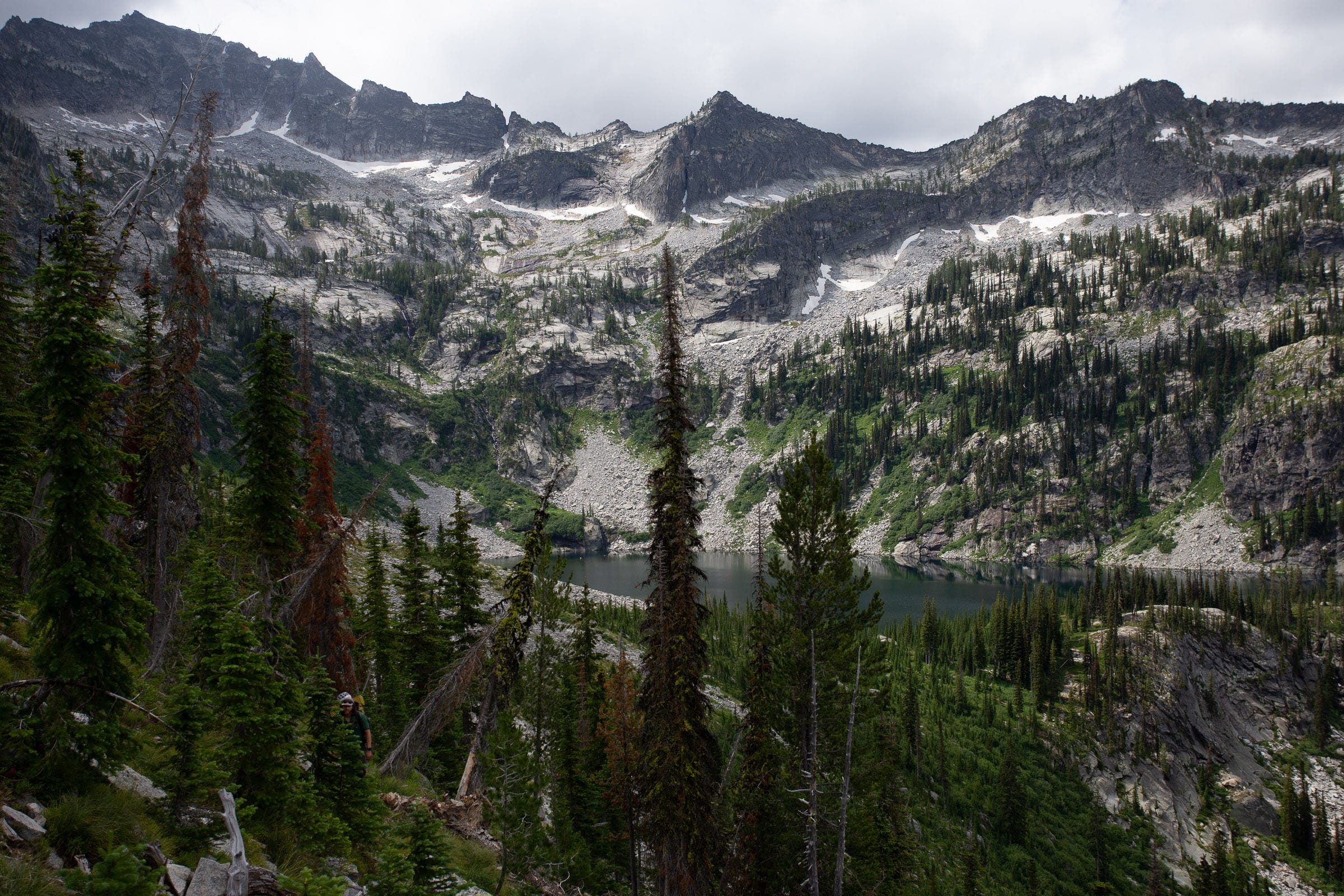
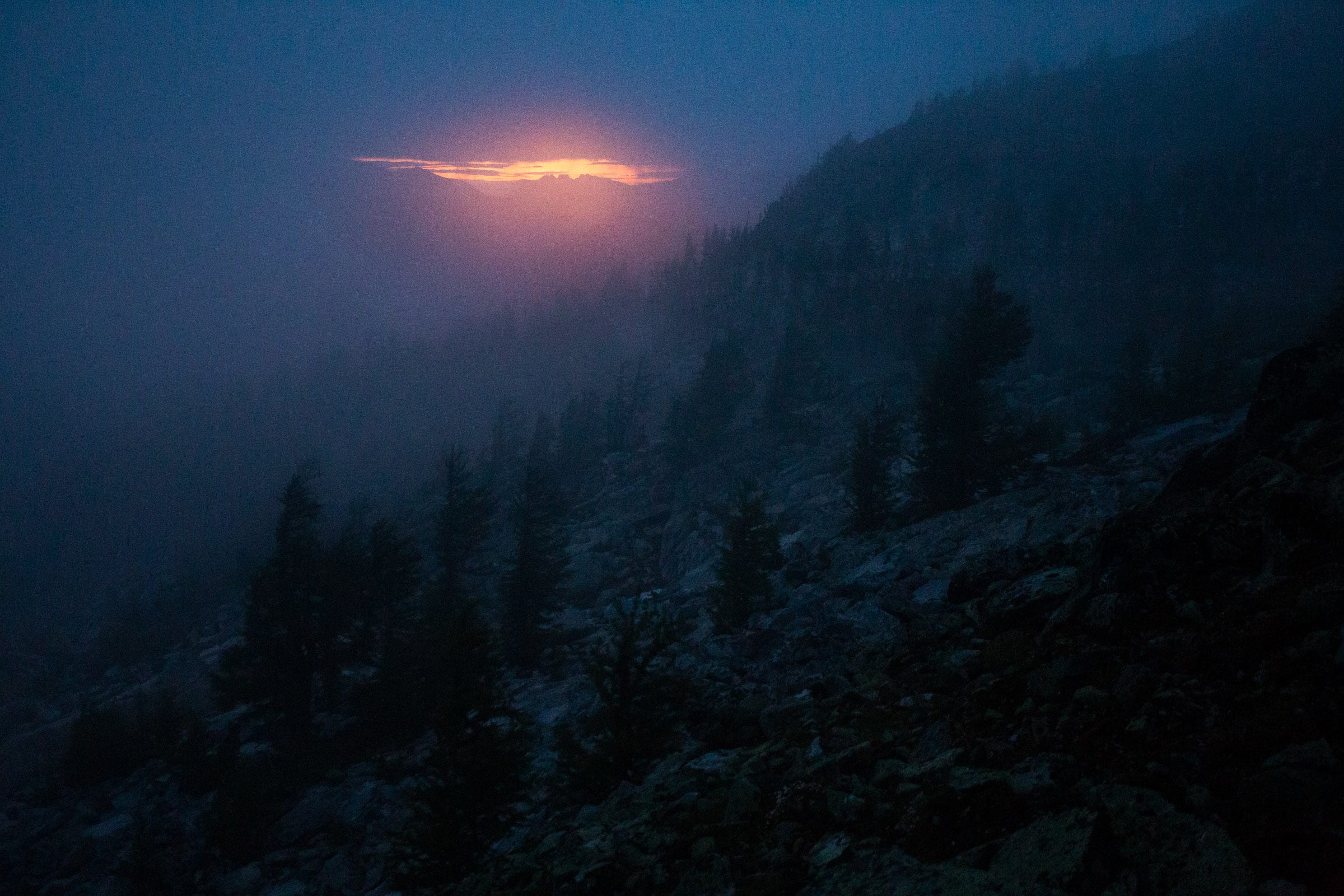
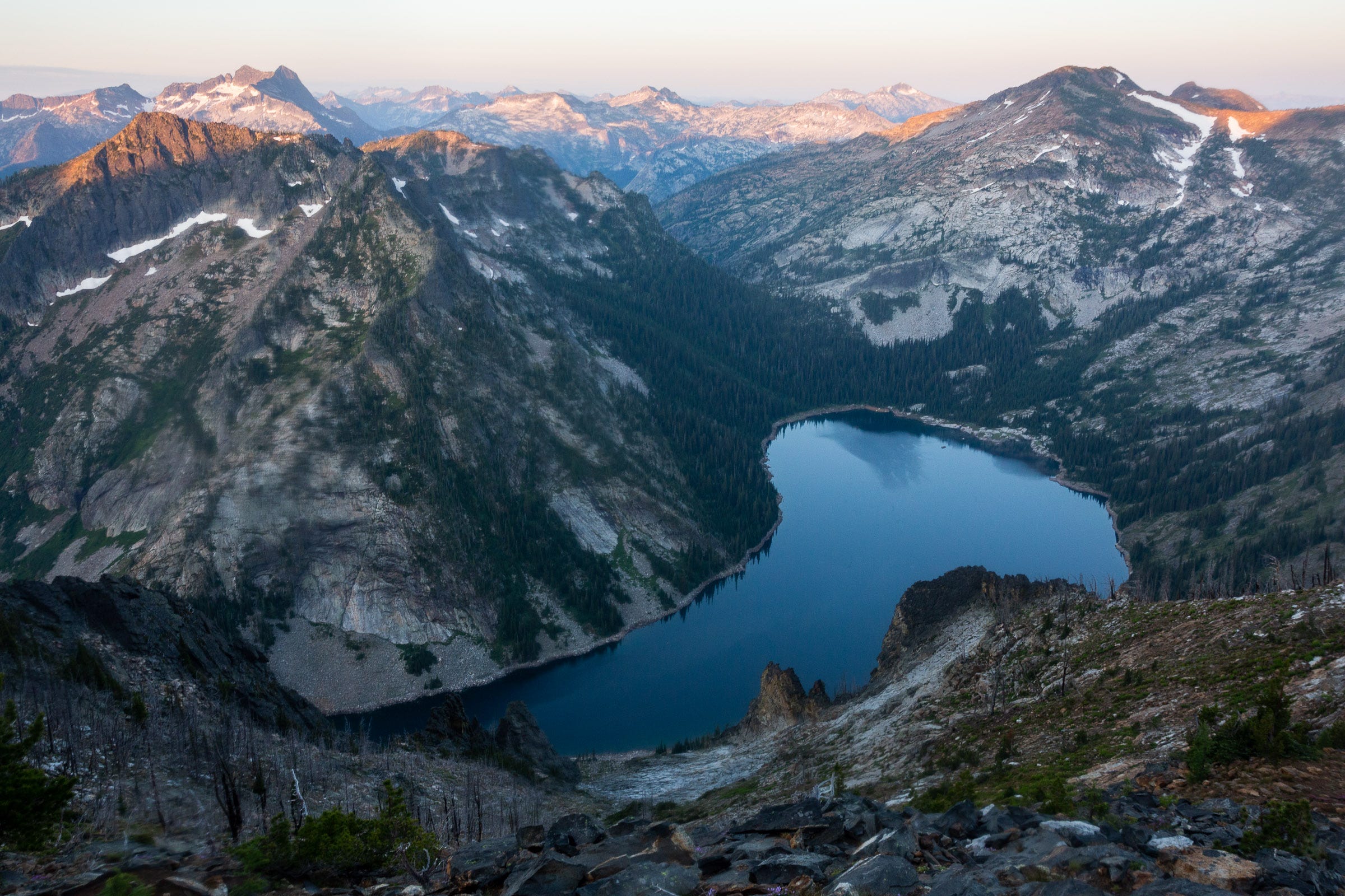
The day kept getting later, with clouds starting to roll in accompanied by a few rain drops. At 7 PM, I finally reached a high point and descended 600 feet on loose talus to a picturesque little lake at 7600’ on the Idaho side. At over 13 hours of travel time, this would be my biggest day, and I greedily devoured biscuits and gravy and my allotted dessert dark chocolate Milanos. I got in my tent and scrutinized the route and terrain for the following day, knowing I might have to adjust things depending on the forecasted rain and potential thunder.
Day 8
13.0 miles | 6670 feet gain | 11:02 hours
The rain started about 3 AM and I decided to give myself an extra hour to sleep in, knowing I needed the rest and hoping the rain might stop. At 6:45 AM, I decided I needed to get a start, even if the drizzle was continuing. I probably made a comical sight heading off, as my stiff and sore legs struggled to get warmed up and I tested out the very wet and slick talus. After slipping almost immediately, I decided to put on my climbing helmet to protect my head from a potential fall on this not-so-steep but very slippery rock.
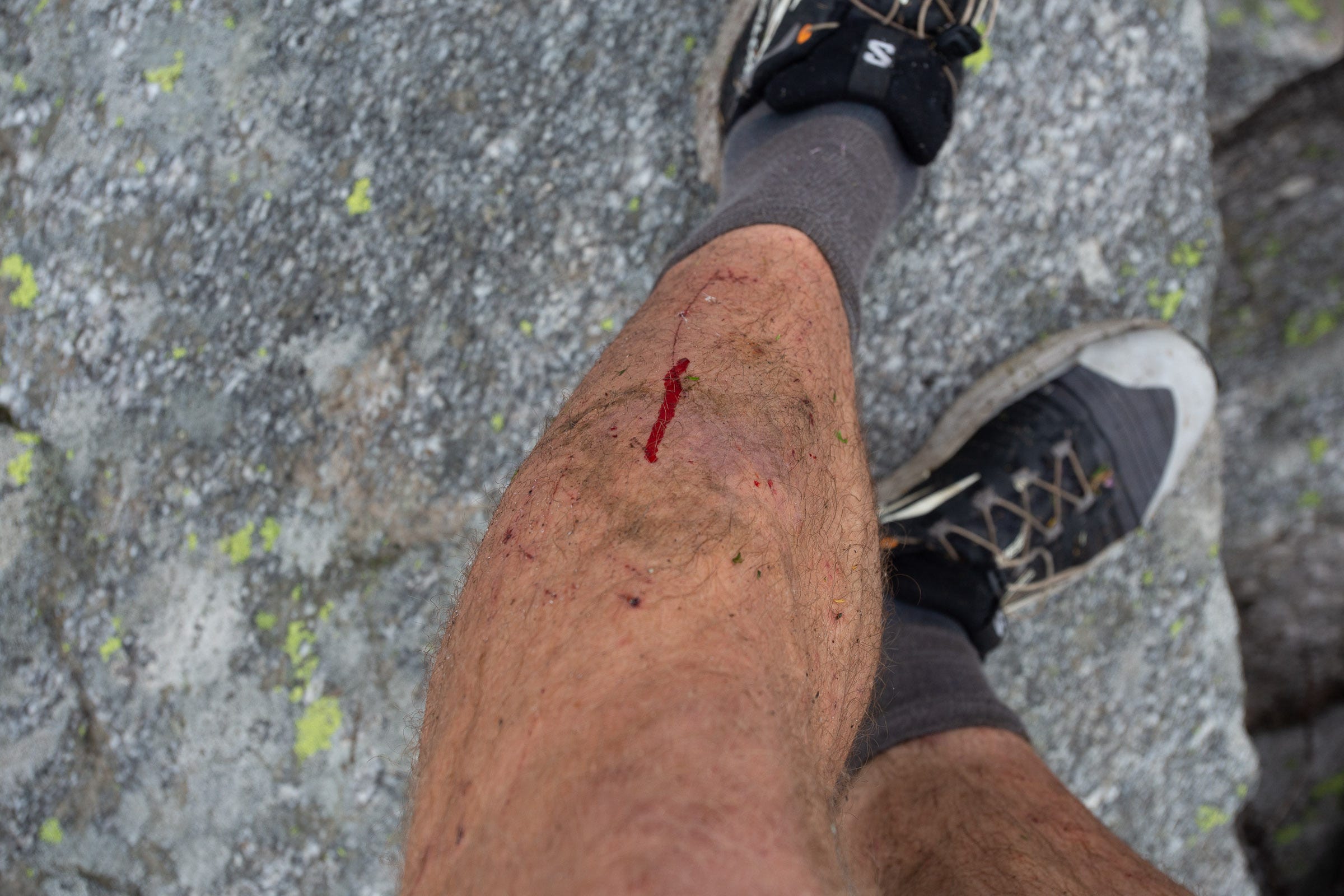
Eventually I made it back to the ridge with more forest cover and better footing. However, I knew I wasn’t going to chance any technical rock portions in the rain. My risk tolerance had become ever more conservative now that I was traveling alone, and I knew that I was miles away from the nearest trail and needed to be very careful in my decision making. After a couple miles of nice, lower angle ridge travel, the mapped crest line drops straight down a cliff just west of Two Lakes. Instead, I followed the ridge north, and traversed across a gentle ramp above Garnet Lake. However, even though the drizzle had recently stopped, everything was still incredibly slippery. I lost my footing and banged my shin hard on a rock, which prompted me to redouble my conscientiousness and travel even more slowly and thoughtfully.
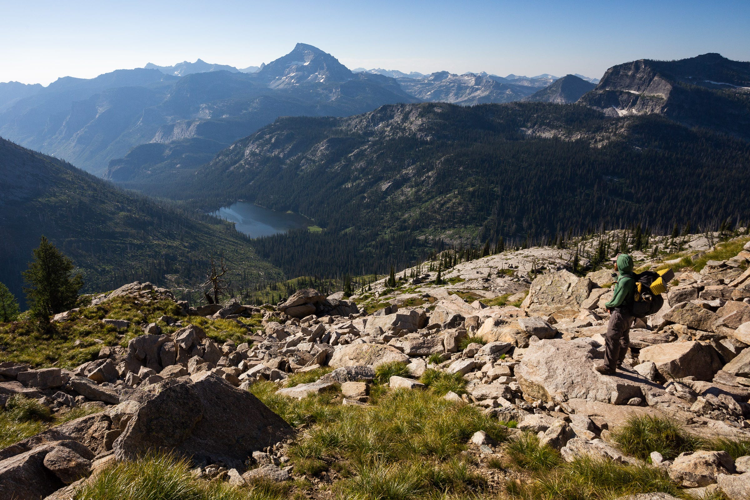
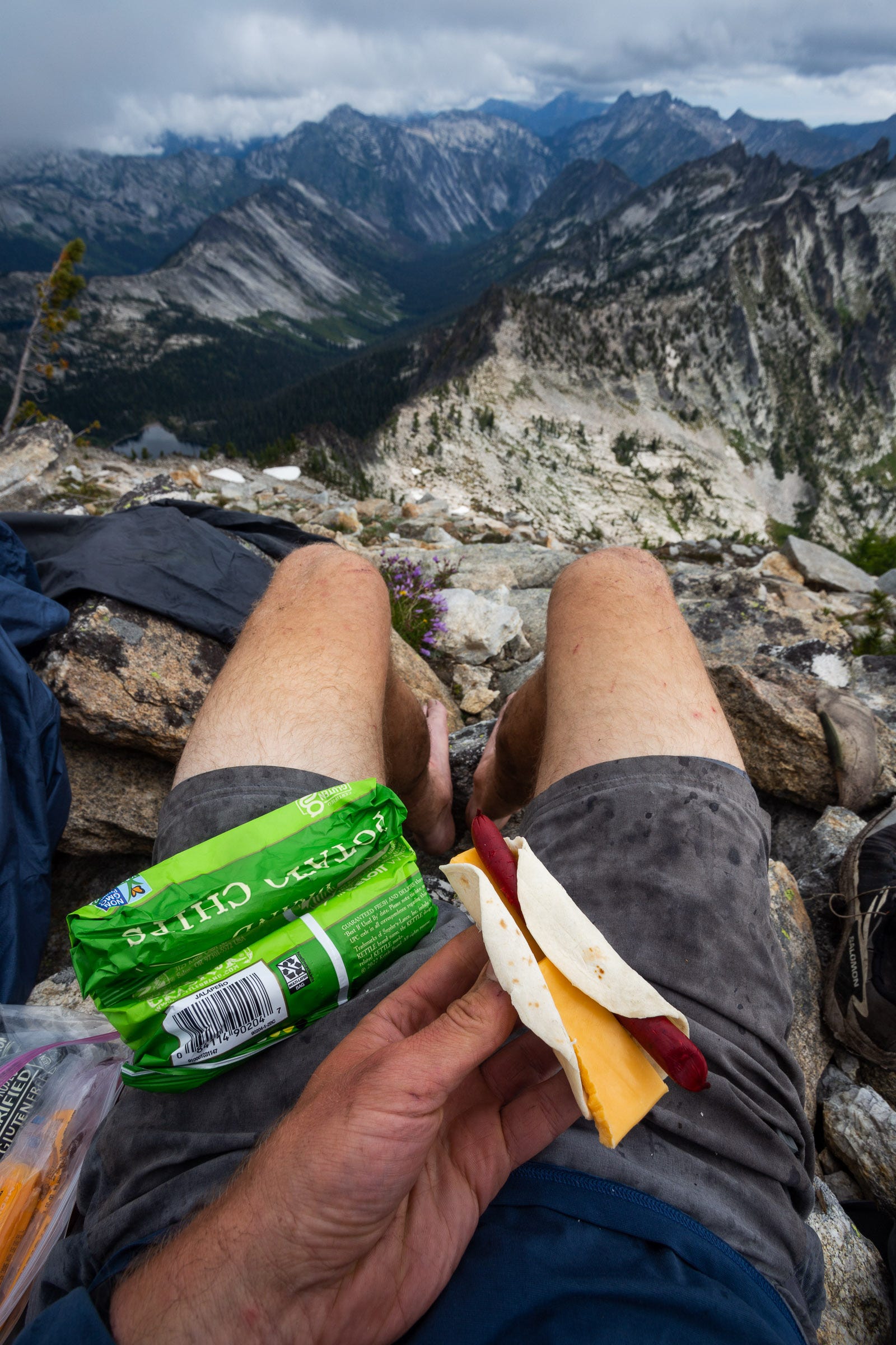
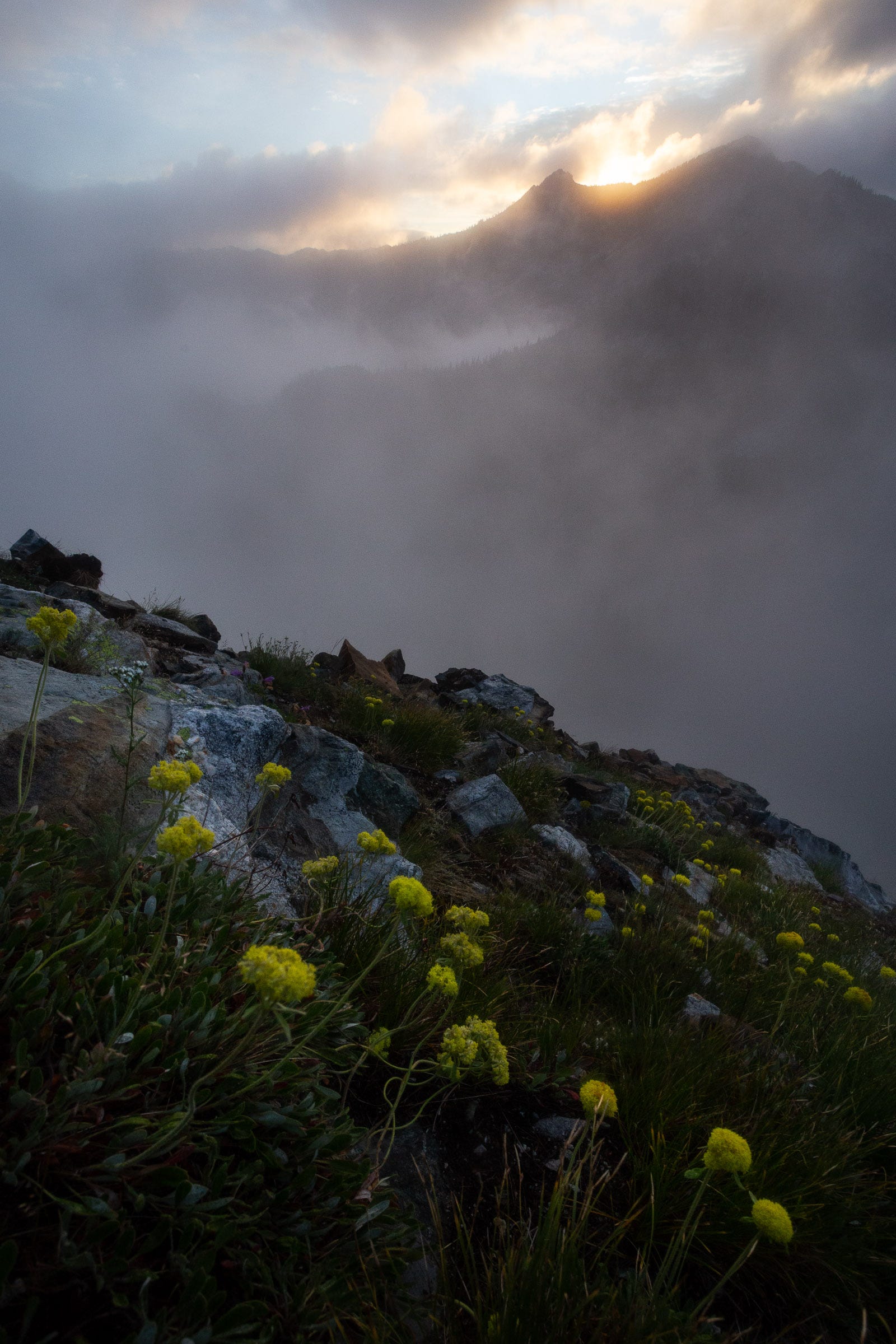
By the time I reached Bear Creek Pass at 11:45 AM, the skies were starting to look a little brighter, with patches of sun appearing here and there. I climbed the 1000’ to Sky Pilot, took off my shoes and socks to try and let them dry, and tucked into a lunch of more kettle chips and a little burrito of sorts with peanut butter, cheese, and little sausages. I had looked forward to reaching Sky Pilot, as it seemed to represent the start of the last big, northern portion. I even realized I could see the lookout on Saint Mary peak far away, which felt like it was relatively “close” to home back in Missoula.
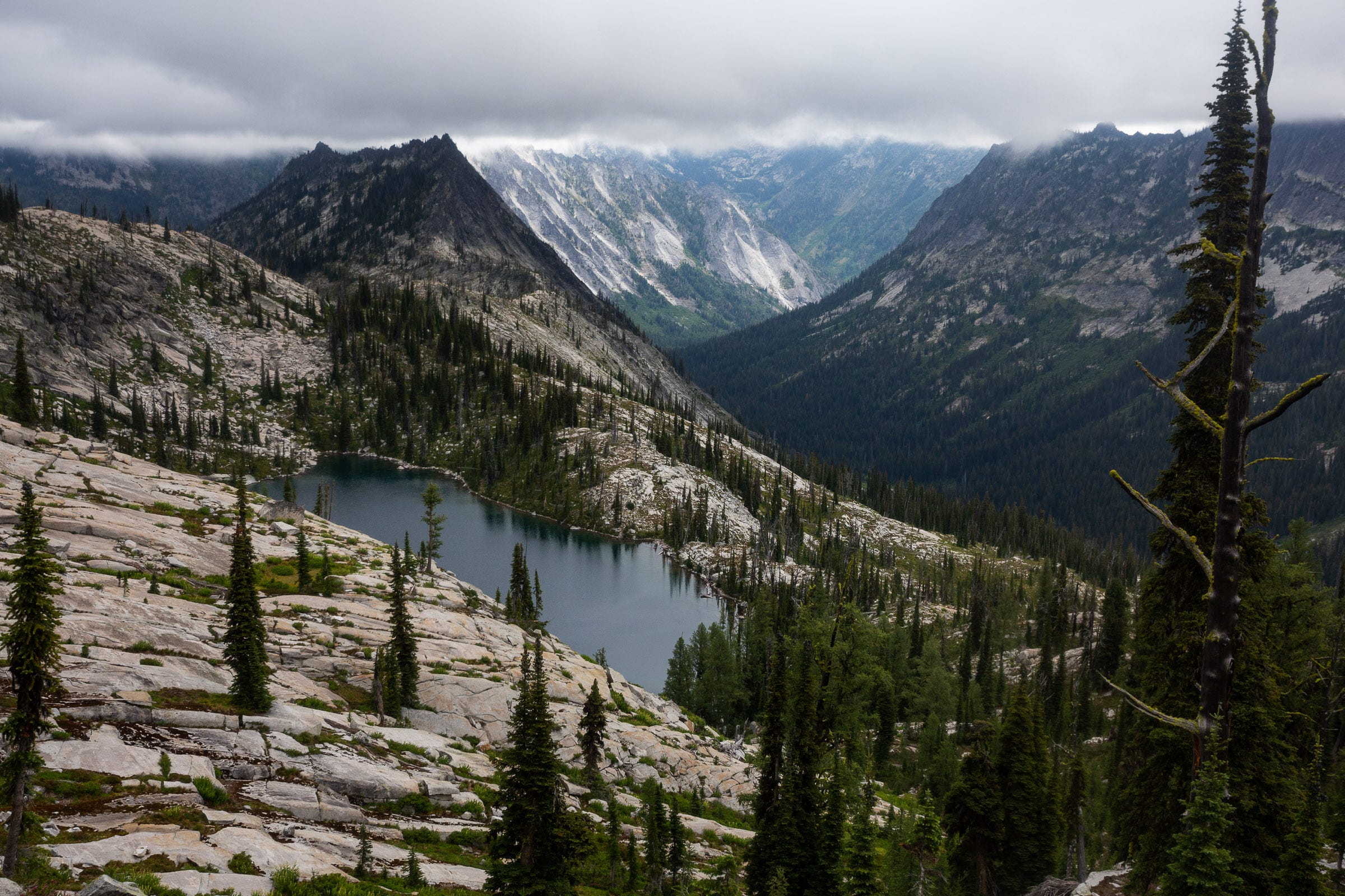
The good weather window didn’t hold for long, and as I descended down from Sky Pilot, another bank of clouds rolled back in. At the saddle, I dropped into the high valley above South Fork Lake for water, before regaining the ridge and startling a moose near Packbox Pass. Looking north across the broad valley of Big Creek Lakes, I hoped to see Ranger Peak—my goal end point for the day—but it was fully obscured by clouds. My optimistic plan was to camp just off the north side of Ranger Peak, in a high basin that I hoped had a little tarn for water. Just to be safe, I had treated a good 4 liters of water from a small tarn west of Packbox Pass, in case there turned out not to be any in my desired camping location.
The rain came back and I had to do some slow, careful climbing down wet, slippery slopes. The ridge to Ranger Peak seemed to go on forever, and it was after 6 PM when I finally reached the top, still fully in a cloud. Not able to get eyes on my intended campsite, I climbed down the northwest ridge of Ranger Peak until there was a little weakness in the cliff wall and I could descend around the edge of the snow bank.
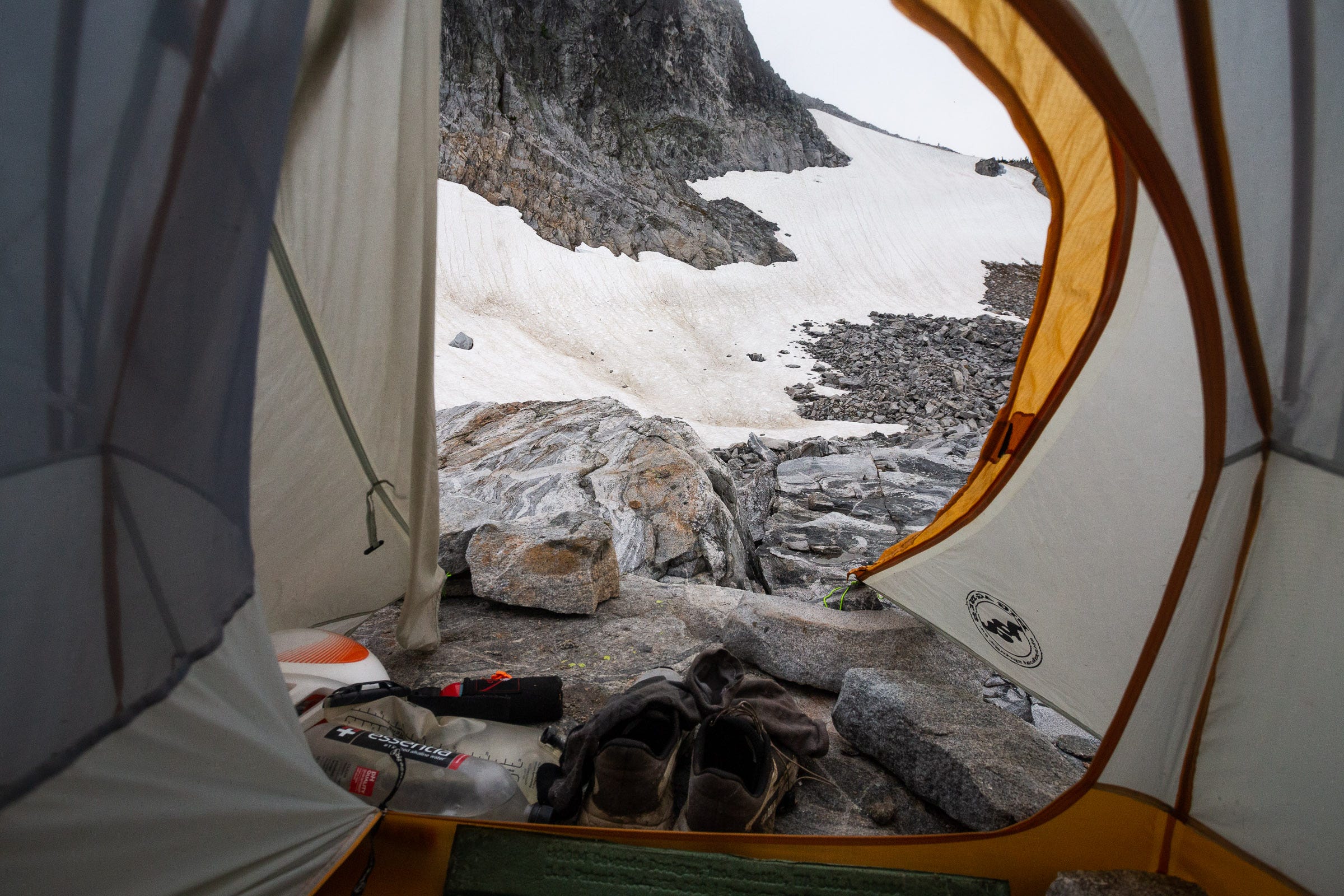
It didn’t take long to see that there was no liquid water source in this high bench. Worse, what looked on the map to be a flat, suitable location for pitching a tent was, in fact, a talus field, covered with car-sized boulders. After doing some reconnoitering, I resigned myself to my fate and chose what appeared to be the only flattish, large enough boulder to pitch a tent on.
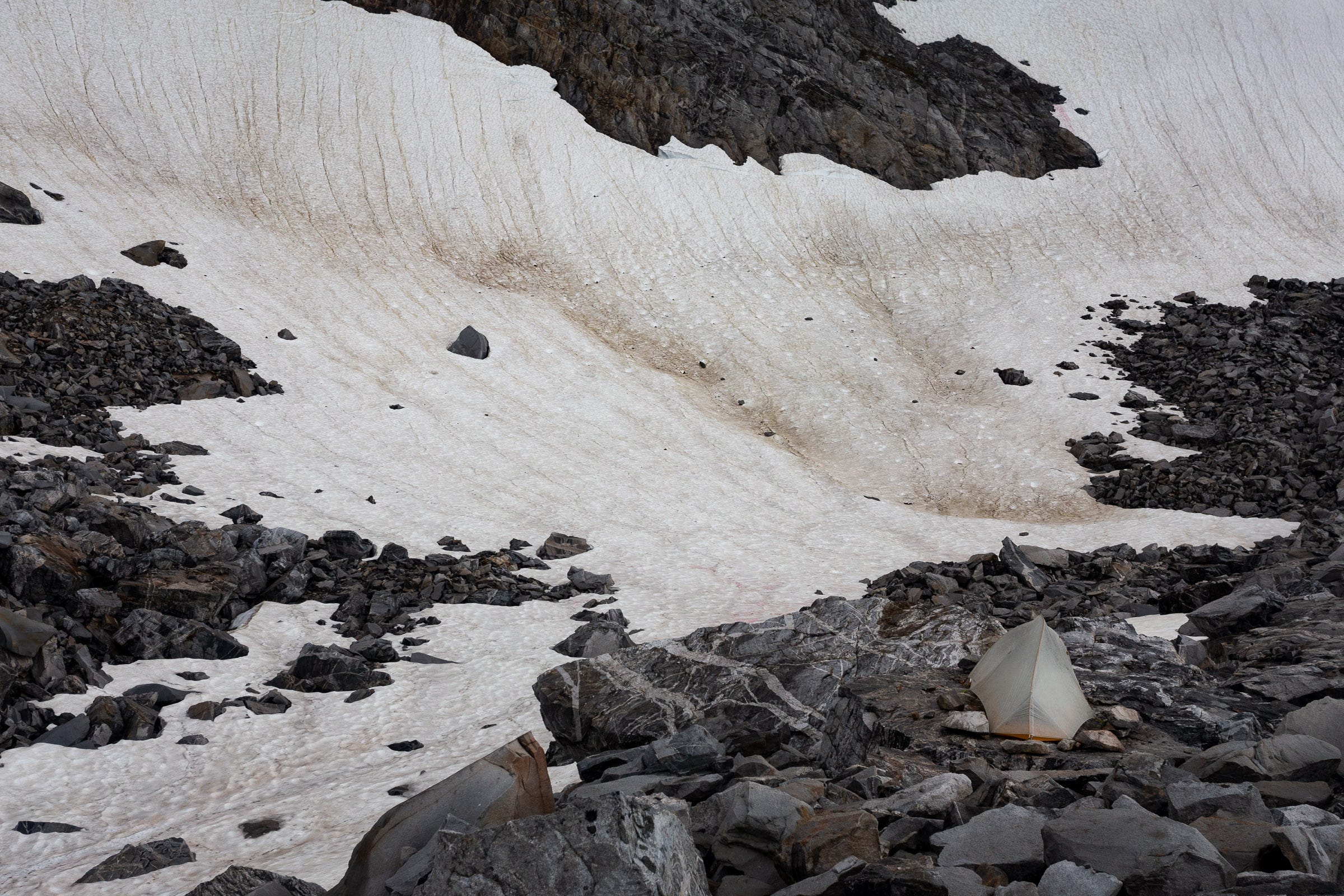
Not being able to use the tent stakes, I tied the guylines to rocks and loaded enough rocks inside the tent to keep it from blowing away in the gusts. A hearty mac and cheese warmed me up and roused my spirits, and this perched campsite actually ended up being my favorite of the traverse—a cozy haven amidst a cold, windy, rocky world out the door.
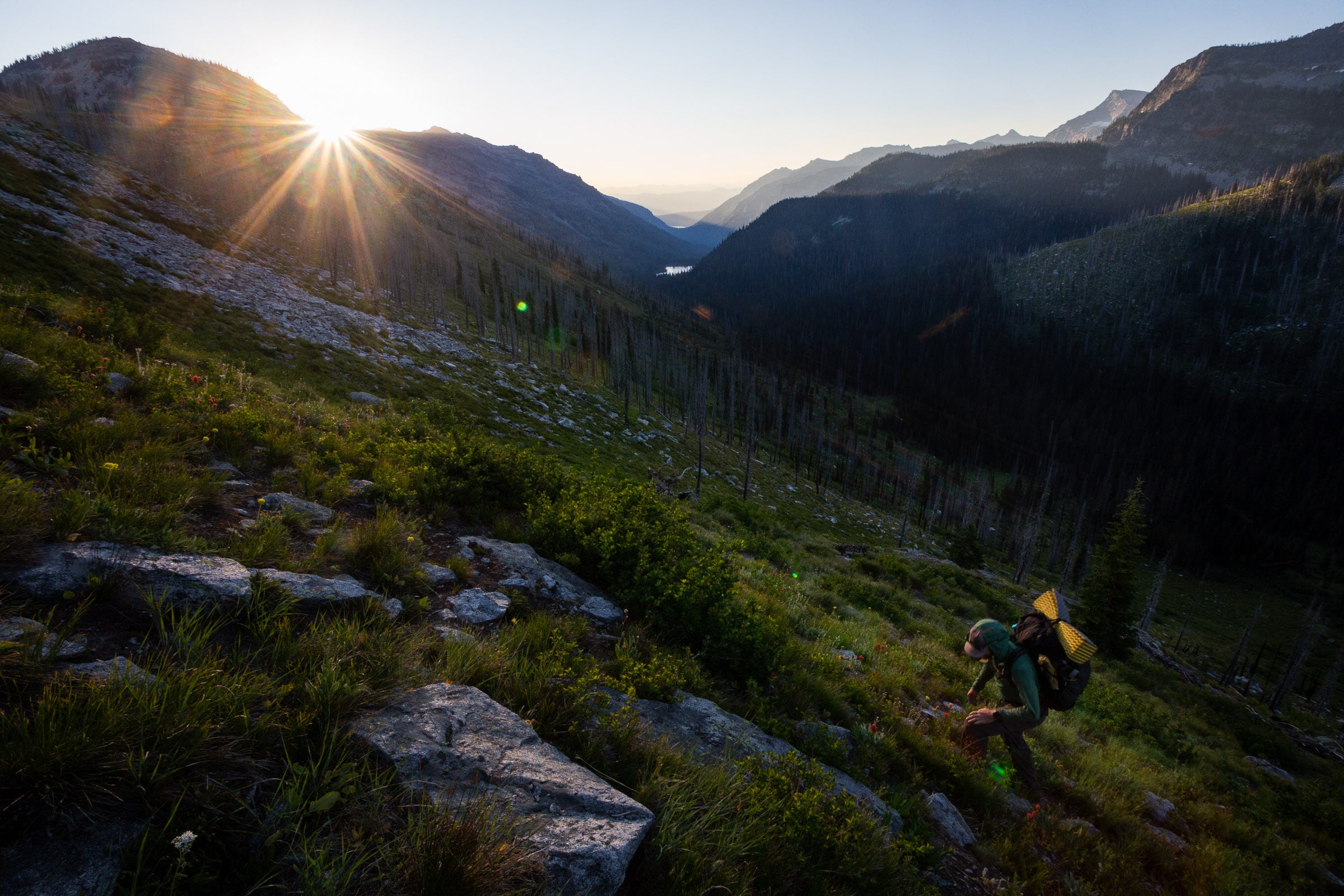
Day 9
13.5 miles | 6539 feet gain |10:43 hours
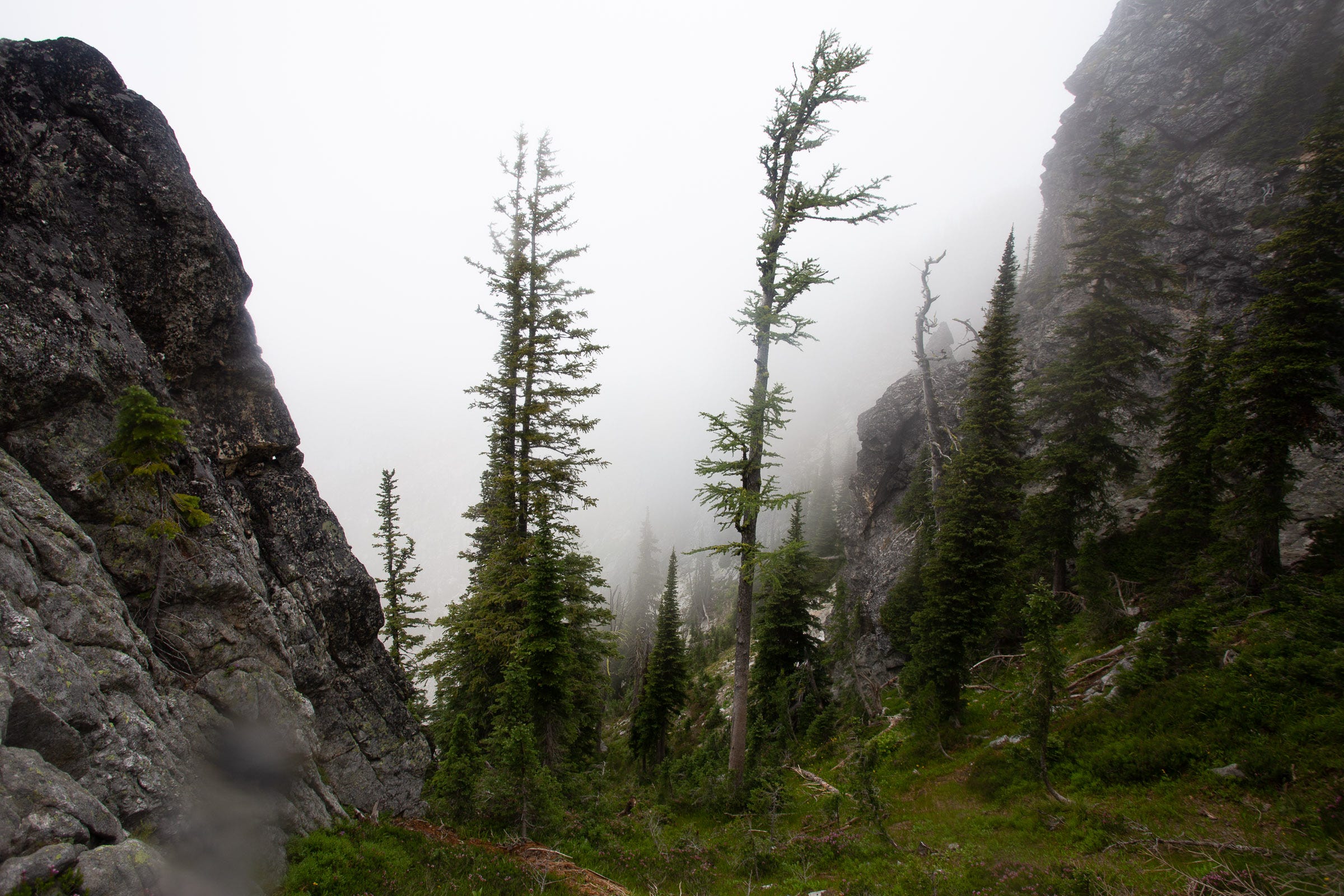
I woke up to a misty glow in the east, excited because the northern terminus of the Bitterroots finally felt within range. Traversing to regain the ridge, I lost my footing on a lowish-angle snowfield, and ended up glissading 50 feet to the other side before getting back to the solid footing of talus and glass. I quickly reached Old Stormy and was treated to magical light and mist the next mile and a half, navigating Class 3 scrambling as I wove in and out of blocky features on the ridge.
As the ridge turned north again, I knew that there were a number of cliffs and gendarmes that would block the main crest and make for very slow going. Here, I was super grateful to have some beta from Nate Bender, who had kindly shared info on his adventures from this point on the ridge all the way to Lolo Peak. I followed his general route, dropping off the main ridge in various places for Class 3 routes that skirted big cliffs.
Rain was back in the forecast, and I had lunch under a thick clump of spruce trees, trying to wait out the worst of it. North of North Kootenai Lake, the Bitterroot Crest diverges from the Montana-Idaho border. My route would head east towards Bass Peak, while the state border veers to the northwest. It was a bit sad to leave this timezone and political line, and the fun evidence of previous travelers in cairns and old rusted survey posts. I dropped into a small lake just south of Bass Peak to refill water, before a scrambling slog up loose scree to Bass Peak. My enjoyment on top was short-lived as more rain came back and I was forced off the south ridge as I looked for a weakness that would allow me to get around to the north. Ultimately, I had to do a slightly sketchy, wet, 4th class downclimb to get back to more safe terrain.
Pretty exhausted by this point, and with very sore legs, I limped my way three more miles down into the first campsite that presented itself—a quaint little lake just over the ridge from Bass Lake on the Idaho side. I quickly set up my tent and got my wet shoes and socks off, to let my early-stage trench foot recover. As I lay in my tent after supper, I looked ahead to what I hoped was my final day (having burned all bridges by eating both of my remaining dinners).
Day 10
14.7 miles | 6293 feet gain | 8:54 hours
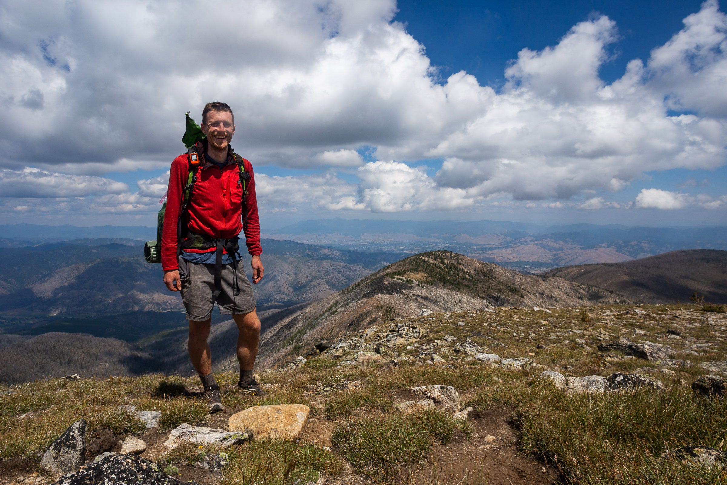
The last day began early and under clear skies. I started moving at 5:40 AM, feeling the stiffness in my knees and legs. The first mile didn’t offer much warmup, with an 1800’ climb in under a mile, but I had settled into a rhythm and felt surprisingly strong. Topping out at Stormy Joe, I stopped to watch the morning alpenglow on the tops of all the peaks over Bass Lake. I was in a much more familiar part of Bitterroot to me, catching glimpses of Little Saint Joe, Sweeney Peak, and other places I had been on hikes not too long ago.
With the exception of a couple little down scrambles, the next 2.5 miles were quick, gradual terrain. At the saddle due west of Pyramid Buttes, I dropped down to avoid a series of cliffy features on the main crest, regaining the ridge above Mills Lake. I started to see even more familiar terrain, including the broad valley of Lolo Creek and the far-off but distinct glint of the West Fork Butte lookout. Now I could see Lolo Peak, not too far off, signifying the final peak of the route. I hiked toward it excitedly and renewed energy.
The connecting ridge south of Lolo Peak presented the last technical challenges, and I probably didn’t take the best line and had to do some Class 4 or low Class 5 climbing back up to regain the narrow ridge top. Finally, I broke out onto the broad sloping ramp up to the south summit of Lolo Peak. I was surprised to notice I could now, for the first time, see familiar landmarks of Missoula—Mount Sentinel just peaking out, and Mount Deanstone.
I was surprised to see movement ahead, and it took several seconds for my brain to register that it was a dog, with its human closely behind. While on route (not counting the folks we had seen at Twin Lakes while camping), this was the first person I had seen over the last 130 miles. I walked to the North summit and sat down for a long lunch, finishing off just about all my remaining snacks. I spent a long while just looking down at Missoula; this beloved little valley that contained so many things that I loved—my partner, my dog, many friends, favorite trails, and more. It was more meaningful than I expected, to see how every ridge and peak connected, and finally led back home.
I messaged my partner on the InReach to let her know my ETA at the trailhead, and headed down the ridge to Carlton Lake. The final miles on trail, through sunny, recently burnt forest passed quickly. As I got closer to the end of the trail, I could feel my emotions rising; mostly relief and excitement to be able to let my body rest, but also some bittersweetness that what had been an intriguing mystery of a route was now in the past. I reached the trailhead, immediately found a shady spot to lay down, take off my shoes and socks, and lounge until my partner Taylor and our dog, Bodie, arrived. I was stoked to finally see them; we headed back to Missoula, with the requisite stop at Dairy Queen for a celebratory concrete mixer.
Many people made this trip possible and helped out in big and small ways. Thanks to Nate Bender for sharing important information from his previous Bitterroot adventures. Sharing the first half with Josh was a joy, and he also helped out greatly with shuttling and other logistics. Finally, I’m deeply grateful to my partner Taylor for holding down the fort for 10 days while I was off playing in the mountains. It wouldn’t have been possible without her.
Thoughts on how fast it could be done
At various points along the way, Josh and I posed some version of the question “how fast do you think Kílian Jornet [insert name of other elite mountain athlete] could do this in?” I completed the whole traverse in 9 days, 10 hours, and 8 minutes. I covered 130.6 miles and 58,695 feet of vertical gain. By my calculation, the ridge proper (without any trips off for water or camping) is 110 miles, with ~54,700 feet of gain. However, taking this direct route would also entail hitting a lot of technical portions head on, which would greatly slow even the strongest athletes. So taking my stats as a general baseline, in theory I’d guess that an elite athlete—with optimal beta and support—could finish it in 4 days at the absolute best (average of 33 miles and 15,000 feet of vert each day). Doing it in 3 days seems, to me, highly unlikely (44 miles and 19,600 feet of vert each day). Speed would of course bring weight benefits, in not having to carry as much food/fuel. However, there are very few locations where a resupply can easily be done, so even a fully supported attempt would likely entail carrying a good amount of food for portions.
The vast majority of the route is also off-trail, making speed difficult. Compared to the Sangre de Cristo Traverse, which I did with my brother in 2020, the Bitterroot Traverse is longer, has more vertical gain, and feels like slower terrain on average. The Sangre de Cristo Traverse FKT is currently 4 days, 11 hours; I’m guessing that the Bitterroot Traverse would realistically take longer. For this trip, we went northbound, which made the pickup easier from Missoula, and also had psychological advantages of heading towards home. I’m not sure that that southbound would have any advantages necessarily; the one road access point to the crest (Lost Horse Creek valley) is about halfway on the route either way. The technical portions are throughout, but perhaps slightly weighted to the southern half.
I hope this trip report is useful to those planning their own traverse (or any other adventure in the Bitterroot). Feel free to reach out if you have any questions; I have a lot of additional photos of various parts of the route that could be useful. I look forward to hearing about the adventures of future folks, it’s grand country out there!